
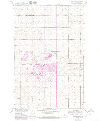
~ Burlington NE ND topo map, 1:24000 scale, 7.5 X 7.5 Minute, Historical, 1979, updated 1980
Burlington NE, North Dakota, USGS topographic map dated 1979.
Includes geographic coordinates (latitude and longitude). This topographic map is suitable for hiking, camping, and exploring, or framing it as a wall map.
Printed on-demand using high resolution imagery, on heavy weight and acid free paper, or alternatively on a variety of synthetic materials.
Topos available on paper, Waterproof, Poly, or Tyvek. Usually shipping rolled, unless combined with other folded maps in one order.
- Product Number: USGS-5474275
- Free digital map download (high-resolution, GeoPDF): Burlington NE, North Dakota (file size: 10 MB)
- Map Size: please refer to the dimensions of the GeoPDF map above
- Weight (paper map): ca. 55 grams
- Map Type: POD USGS Topographic Map
- Map Series: HTMC
- Map Verison: Historical
- Cell ID: 6278
- Scan ID: 283599
- Imprint Year: 1980
- Woodland Tint: Yes
- Photo Revision Year: 1979
- Aerial Photo Year: 1977
- Edit Year: 1979
- Datum: NAD27
- Map Projection: Polyconic
- Map published by United States Geological Survey
- Map Language: English
- Scanner Resolution: 600 dpi
- Map Cell Name: Burlington NE
- Grid size: 7.5 X 7.5 Minute
- Date on map: 1979
- Map Scale: 1:24000
- Geographical region: North Dakota, United States
Neighboring Maps:
All neighboring USGS topo maps are available for sale online at a variety of scales.
Spatial coverage:
Topo map Burlington NE, North Dakota, covers the geographical area associated the following places:
- Copeland School Number 1 - School Number 2 - Montessori of Minot School - Rough Rider Golf Course - Dakota Elementary School - Department of Defense 5th Medical Group Ambulance Service - Minot Air Force Base Census Designated Place - Minot Air Force Base Library - United States Air Force Regional Hospital - Minot Air Force Base Fire Department - Township of Tatman - School Number 3 - Minot Air Force Base - Lynch Church - Memorial Middle School - School Number 3 - Minot Air Force Base - School Number 4 - North Plains Elementary School
- Map Area ID: AREA48.548.375-101.375-101.25
- Northwest corner Lat/Long code: USGSNW48.5-101.375
- Northeast corner Lat/Long code: USGSNE48.5-101.25
- Southwest corner Lat/Long code: USGSSW48.375-101.375
- Southeast corner Lat/Long code: USGSSE48.375-101.25
- Northern map edge Latitude: 48.5
- Southern map edge Latitude: 48.375
- Western map edge Longitude: -101.375
- Eastern map edge Longitude: -101.25


