
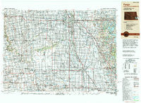
~ Fargo ND topo map, 1:250000 scale, 1 X 2 Degree, Historical, 1989, updated 1990
Fargo, North Dakota, USGS topographic map dated 1989.
Includes geographic coordinates (latitude and longitude). This topographic map is suitable for hiking, camping, and exploring, or framing it as a wall map.
Printed on-demand using high resolution imagery, on heavy weight and acid free paper, or alternatively on a variety of synthetic materials.
Topos available on paper, Waterproof, Poly, or Tyvek. Usually shipping rolled, unless combined with other folded maps in one order.
- Product Number: USGS-5473755
- Free digital map download (high-resolution, GeoPDF): Fargo, North Dakota (file size: 21 MB)
- Map Size: please refer to the dimensions of the GeoPDF map above
- Weight (paper map): ca. 55 grams
- Map Type: POD USGS Topographic Map
- Map Series: HTMC
- Map Verison: Historical
- Cell ID: 68776
- Scan ID: 285520
- Imprint Year: 1990
- Woodland Tint: Yes
- Edit Year: 1989
- Datum: NAD83
- Map Projection: Transverse Mercator
- Map published by United States Geological Survey
- Map Language: English
- Scanner Resolution: 600 dpi
- Map Cell Name: Fargo
- Grid size: 1 X 2 Degree
- Date on map: 1989
- Map Scale: 1:250000
- Geographical region: North Dakota, United States
Neighboring Maps:
All neighboring USGS topo maps are available for sale online at a variety of scales.
Spatial coverage:
Topo map Fargo, North Dakota, covers the geographical area associated the following places:
- Erhard - Dwight - Fingal - Fairview Junction - River Bluff Estates - Prosper - Anselm - Nashua - Hitterdal - Finkle - Rutland - Hankinson - North Shore Trailer Park - Tower City - Western - Mapleton - Green Acres Mobile Park - Frontier - Downer - Parkdale - Kibby (historical) - Casselton - Elizabeth - Norman - Hickson - Stiles - Fergus Falls - Barney - Fargo - Doran - Woods - Saint Benedict - Wahpeton - Oxbow - Colfax - Roberts (historical) - Reiles Acres - Baker - Embden - Nome - Riverside - Wolverton - Galchutt - West Fargo - Bayne - Coburn - Abercrombie - Rothsay - Walcott - Fife - Brockway (historical) - Pitcairn - Winnipeg Junction - Dulsky Mobile Home Court - Cormorant - Lake Park - Manitoba Junction - Kathryn - Park Lane Mobile Home Park - Venlo - Peak - Mavis Frazier Trailer Park - Hample - Lithia - Farmington - Tansem - Oriska - Pelican Rapids Mobile Home Park - Oakport - Cogswell - Hoving - Straubville - Boise De Sioux Mobile Estates - Pelican Rapids - Kent - Cuba - Power - Gwinner - Wheatland - Hereford (historical) - Great Bend - Lidgerwood - Averill - Childs - Enloe - Daily - Dale - Muskoda - Greenwood Communities - Oswald - Wild Rice - Forman - Norwegian Grove - Warren - Everest - Country Manor Mobile Home Park - Kindred - Briarwood - Absaraka - Tenney
- Map Area ID: AREA4746-98-96
- Northwest corner Lat/Long code: USGSNW47-98
- Northeast corner Lat/Long code: USGSNE47-96
- Southwest corner Lat/Long code: USGSSW46-98
- Southeast corner Lat/Long code: USGSSE46-96
- Northern map edge Latitude: 47
- Southern map edge Latitude: 46
- Western map edge Longitude: -98
- Eastern map edge Longitude: -96


