
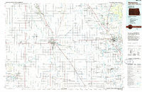
~ Wahpeton ND topo map, 1:100000 scale, 30 X 60 Minute, Historical, 1985, updated 1986
Wahpeton, North Dakota, USGS topographic map dated 1985.
Includes geographic coordinates (latitude and longitude). This topographic map is suitable for hiking, camping, and exploring, or framing it as a wall map.
Printed on-demand using high resolution imagery, on heavy weight and acid free paper, or alternatively on a variety of synthetic materials.
Topos available on paper, Waterproof, Poly, or Tyvek. Usually shipping rolled, unless combined with other folded maps in one order.
- Product Number: USGS-5473629
- Free digital map download (high-resolution, GeoPDF): Wahpeton, North Dakota (file size: 19 MB)
- Map Size: please refer to the dimensions of the GeoPDF map above
- Weight (paper map): ca. 55 grams
- Map Type: POD USGS Topographic Map
- Map Series: HTMC
- Map Verison: Historical
- Cell ID: 68537
- Scan ID: 285457
- Imprint Year: 1986
- Woodland Tint: Yes
- Aerial Photo Year: 1984
- Edit Year: 1985
- Datum: NAD27
- Map Projection: Universal Transverse Mercator
- Planimetric: Yes
- Map published by United States Geological Survey
- Map Language: English
- Scanner Resolution: 600 dpi
- Map Cell Name: Wahpeton
- Grid size: 30 X 60 Minute
- Date on map: 1985
- Map Scale: 1:100000
- Geographical region: North Dakota, United States
Neighboring Maps:
All neighboring USGS topo maps are available for sale online at a variety of scales.
Spatial coverage:
Topo map Wahpeton, North Dakota, covers the geographical area associated the following places:
- Lakeview Estates - River Bluff Estates - Campbell - Mantador - French - Rothsay Mobile Home Park - Colfax - Fairmount - Erhard - Roberts (historical) - Dwight - Fergus Falls - Elmore - Farmington - Kent - Squier - Doran - Sonora - Mooreton - Boise De Sioux Mobile Estates - Enloe - Pitcairn - Breckenridge - Western - Great Bend - Fairview Junction - Hereford (historical) - Nashua - Elizabeth - Foxhome - Wahpeton - Carlisle - Wendell - Parkdale - McCauleyville - Abercrombie - Galchutt - Brushvale - Country Manor Mobile Home Park - Oswald - Tyler - Childs - Tintah - Bayne - Tenney - Rothsay - Hankinson - Everdell - Green Acres Mobile Park
- Map Area ID: AREA46.546-97-96
- Northwest corner Lat/Long code: USGSNW46.5-97
- Northeast corner Lat/Long code: USGSNE46.5-96
- Southwest corner Lat/Long code: USGSSW46-97
- Southeast corner Lat/Long code: USGSSE46-96
- Northern map edge Latitude: 46.5
- Southern map edge Latitude: 46
- Western map edge Longitude: -97
- Eastern map edge Longitude: -96


