
~ McAlester OK topo map, 1:250000 scale, 1 X 2 Degree, Historical, 1965, updated 1965
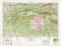
McAlester, Oklahoma, USGS topographic map dated 1965.
Includes geographic coordinates (latitude and longitude). This topographic map is suitable for hiking, camping, and exploring, or framing it as a wall map.
Printed on-demand using high resolution imagery, on heavy weight and acid free paper, or alternatively on a variety of synthetic materials.
Topos available on paper, Waterproof, Poly, or Tyvek. Usually shipping rolled, unless combined with other folded maps in one order.
- Product Number: USGS-5473173
- Free digital map download (high-resolution, GeoPDF): McAlester, Oklahoma (file size: 16 MB)
- Map Size: please refer to the dimensions of the GeoPDF map above
- Weight (paper map): ca. 55 grams
- Map Type: POD USGS Topographic Map
- Map Series: HTMC
- Map Verison: Historical
- Cell ID: 68897
- Scan ID: 800934
- Imprint Year: 1965
- Woodland Tint: Yes
- Aerial Photo Year: 1946
- Datum: NAD27
- Map Projection: Transverse Mercator
- Map published by United States Army Corps of Engineers
- Map published by United States Army
- Map Language: English
- Scanner Resolution: 508 dpi
- Map Cell Name: McAlester
- Grid size: 1 X 2 Degree
- Date on map: 1965
- Map Scale: 1:250000
- Geographical region: Oklahoma, United States
Neighboring Maps:
All neighboring USGS topo maps are available for sale online at a variety of scales.
Spatial coverage:
Topo map McAlester, Oklahoma, covers the geographical area associated the following places:
- Golden - Red Wing - Bengal - Shady Grove - Nolia - Albion - Geneva - Pryor Ridge (historical) - Alikchi - Battle Hill (historical) - Posey Hollow - Ink - Reynolds - Bowers - Limestone Gap - Hatfield - Lutie - Haileyville - Faulkner Springs - Kosoma - Chilli - Pullman - Weeks - Cove - Wadena - Eagletown - Midway (historical) - Colburn Spring (historical) - Sugar Creek - Veterans Colony - Sawyer - Cade - King - Nunley - Hiawatha - Mount Herman - Mountain Fork - Apex - Old Euclid (historical) - Conser - Chapel Hill - Richville - Dela - Haywood - Burg - Patterson - Blansett - Brewer - Baker Springs - Sardis - Beachton - Forrester - Monroe - Big Rocks - Howe - Holly Grove - Duckett - Nashoba - Burg - Tintop - Darwin - Ringold - Ultima Thule - Damon - Old Union (historical) - Wister - North Pole - Wright City - Wesley - Finley - Boehler - Pine Grove - Spencerville - Norris - Gowen - Rufe - Kiowa - Sherwood - Pleasant Valley - Whitesboro - Fugate - Sensation (historical) - Cedar Hill (historical) - Vandervoort - Bache - Glendale - Muse - Red Hill (historical) - Denman - Antlers - Kellond - Plunketville - Glover - Alderson - Oak Grove - High Hill - Nella - Centerville - Gipson - Yocana
- Map Area ID: AREA3534-96-94
- Northwest corner Lat/Long code: USGSNW35-96
- Northeast corner Lat/Long code: USGSNE35-94
- Southwest corner Lat/Long code: USGSSW34-96
- Southeast corner Lat/Long code: USGSSE34-94
- Northern map edge Latitude: 35
- Southern map edge Latitude: 34
- Western map edge Longitude: -96
- Eastern map edge Longitude: -94


