
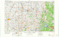
~ Enid OK topo map, 1:250000 scale, 1 X 2 Degree, Historical, 1955, updated 1974
Enid, Oklahoma, USGS topographic map dated 1955.
Includes geographic coordinates (latitude and longitude). This topographic map is suitable for hiking, camping, and exploring, or framing it as a wall map.
Printed on-demand using high resolution imagery, on heavy weight and acid free paper, or alternatively on a variety of synthetic materials.
Topos available on paper, Waterproof, Poly, or Tyvek. Usually shipping rolled, unless combined with other folded maps in one order.
- Product Number: USGS-5473163
- Free digital map download (high-resolution, GeoPDF): Enid, Oklahoma (file size: 14 MB)
- Map Size: please refer to the dimensions of the GeoPDF map above
- Weight (paper map): ca. 55 grams
- Map Type: POD USGS Topographic Map
- Map Series: HTMC
- Map Verison: Historical
- Cell ID: 68769
- Scan ID: 802251
- Imprint Year: 1974
- Woodland Tint: Yes
- Edit Year: 1965
- Field Check Year: 1955
- Datum: Unstated
- Map Projection: Transverse Mercator
- Map published by United States Geological Survey
- Map Language: English
- Scanner Resolution: 508 dpi
- Map Cell Name: Enid
- Grid size: 1 X 2 Degree
- Date on map: 1955
- Map Scale: 1:250000
- Geographical region: Oklahoma, United States
Neighboring Maps:
All neighboring USGS topo maps are available for sale online at a variety of scales.
Spatial coverage:
Topo map Enid, Oklahoma, covers the geographical area associated the following places:
- Marshall - White Eagle - Frey - Fairmont - Casey - Tonkawa - Player - Hennessey - Uncas - Lucien - Waukomis - Nichols - McCord - Hulah - Cartoco - Orlando - Ingalls - Blanton - Drace - Boulangerville - Kengle - Bowden - Cedar Ridge - Grainville - Oilton - Alcorn - McMahon - Lotsee - Wakita - Kaw Agency (historical) - Renfrow - Sha-To-She - Douglas - McFadden Cove - Grainola - Ponca City - Frankfort - Pearsonia - Curchece - Lep - Tyner - Foraker - Price - Autwine - Shirk - Indian Village - Eddy - Wynona - Lyman - Gray Horse - Barnsdall - Maramec - Sumner - Olive - Bowring - Herd - Skedee - Stillwater - Kildare - Hominy - Enid - Shea - Rigsby - Polk - Schlegel - Cropper - Prattville - Red Fork - Medford - Leroy - Kremlin - Jennings - Pond Creek - Ripley - Westport - Peterman Ridge - Morrison - Sand Springs - Hickory Hill - Roxana - Oak Grove - Hardy - Ralston - Midway - Yost - Bills Corner - Red Rock - Rabornville - Numa - Whippoorwill - Pemeta - Little Chief - Buffalo Springs Stage Station (historical) - Opah - Bender - Etna - Shidler - Cleveland - Washunga - Nardin
- Map Area ID: AREA3736-98-96
- Northwest corner Lat/Long code: USGSNW37-98
- Northeast corner Lat/Long code: USGSNE37-96
- Southwest corner Lat/Long code: USGSSW36-98
- Southeast corner Lat/Long code: USGSSE36-96
- Northern map edge Latitude: 37
- Southern map edge Latitude: 36
- Western map edge Longitude: -98
- Eastern map edge Longitude: -96


