
~ Pawhuska OK topo map, 1:100000 scale, 30 X 60 Minute, Historical, 1985, updated 1986
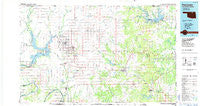
Pawhuska, Oklahoma, USGS topographic map dated 1985.
Includes geographic coordinates (latitude and longitude). This topographic map is suitable for hiking, camping, and exploring, or framing it as a wall map.
Printed on-demand using high resolution imagery, on heavy weight and acid free paper, or alternatively on a variety of synthetic materials.
Topos available on paper, Waterproof, Poly, or Tyvek. Usually shipping rolled, unless combined with other folded maps in one order.
- Product Number: USGS-5472777
- Free digital map download (high-resolution, GeoPDF): Pawhuska, Oklahoma (file size: 18 MB)
- Map Size: please refer to the dimensions of the GeoPDF map above
- Weight (paper map): ca. 55 grams
- Map Type: POD USGS Topographic Map
- Map Series: HTMC
- Map Verison: Historical
- Cell ID: 72186
- Scan ID: 707162
- Imprint Year: 1986
- Woodland Tint: Yes
- Aerial Photo Year: 1981
- Edit Year: 1985
- Datum: NAD27
- Map Projection: Universal Transverse Mercator
- Planimetric: Yes
- Map published by United States Geological Survey
- Map Language: English
- Scanner Resolution: 508 dpi
- Map Cell Name: Pawhuska
- Grid size: 30 X 60 Minute
- Date on map: 1985
- Map Scale: 1:100000
- Geographical region: Oklahoma, United States
Neighboring Maps:
All neighboring USGS topo maps are available for sale online at a variety of scales.
Spatial coverage:
Topo map Pawhuska, Oklahoma, covers the geographical area associated the following places:
- Washunga - Woolaroc - Remington - Little Chief - Doga - Bigheart - Soldani - Hickory Hill - Boulanger Landing - Pawhuska - Tallant - Nelagoney - Myers - Kaw City - Whippoorwill - Carter Nine - Nanos - Ralston - Blackland - Hulah - Pershing - Shidler - Barnsdall - Osage Junction - Apperson - Foraker - Boulangerville - McFadden Cove - Frankfort - Strohm - Fairfax - Pearsonia - Oak Ridge - Grainola - Uncas - Gilland - Bowring - Torpedo - Lep - Kiheki - Wynona - Fite - Hardy - Gray Horse - Okesa - Webb City - Wolco - Opah - Kaw Agency (historical) - Burbank - Lyman - Cooper - Nichols - Herd
- Map Area ID: AREA3736.5-97-96
- Northwest corner Lat/Long code: USGSNW37-97
- Northeast corner Lat/Long code: USGSNE37-96
- Southwest corner Lat/Long code: USGSSW36.5-97
- Southeast corner Lat/Long code: USGSSE36.5-96
- Northern map edge Latitude: 37
- Southern map edge Latitude: 36.5
- Western map edge Longitude: -97
- Eastern map edge Longitude: -96


