
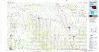
~ Pauls Valley OK topo map, 1:100000 scale, 30 X 60 Minute, Historical, 1986, updated 1986
Pauls Valley, Oklahoma, USGS topographic map dated 1986.
Includes geographic coordinates (latitude and longitude). This topographic map is suitable for hiking, camping, and exploring, or framing it as a wall map.
Printed on-demand using high resolution imagery, on heavy weight and acid free paper, or alternatively on a variety of synthetic materials.
Topos available on paper, Waterproof, Poly, or Tyvek. Usually shipping rolled, unless combined with other folded maps in one order.
- Product Number: USGS-5472775
- Free digital map download (high-resolution, GeoPDF): Pauls Valley, Oklahoma (file size: 17 MB)
- Map Size: please refer to the dimensions of the GeoPDF map above
- Weight (paper map): ca. 55 grams
- Map Type: POD USGS Topographic Map
- Map Series: HTMC
- Map Verison: Historical
- Cell ID: 68128
- Scan ID: 707160
- Imprint Year: 1986
- Woodland Tint: Yes
- Edit Year: 1986
- Datum: NAD27
- Map Projection: Universal Transverse Mercator
- Planimetric: Yes
- Map published by United States Geological Survey
- Map Language: English
- Scanner Resolution: 508 dpi
- Map Cell Name: Pauls Valley
- Grid size: 30 X 60 Minute
- Date on map: 1986
- Map Scale: 1:100000
- Geographical region: Oklahoma, United States
Neighboring Maps:
All neighboring USGS topo maps are available for sale online at a variety of scales.
Spatial coverage:
Topo map Pauls Valley, Oklahoma, covers the geographical area associated the following places:
- McCarty - Wynnewood - Tussy - Rosedale - Pauls Valley - Stealy - Rush Springs - Alex - Box - Wayne - Pernell - Duncan - Civit - Bradley - Satterwhite - White Bead Hill (historical) - Elmore City - Byars - Katie - Cox City - Ninnekah - Wanette - Maysville - Brady - Foster - Corbett - Carver - Eola - Bailey - Hoover - White Bead - Chigley - Lindsay - Antioch - Marlow - Hennepin - Story - Wallville - Neill - Davis - Criner - Purdy - Agawam - Norge - Washita - Bray - Payne - Joy - Johnsonville - Hope - Iona - Erin Springs - Paoli - Marlow - Boudinot - Whitebead
- Map Area ID: AREA3534.5-98-97
- Northwest corner Lat/Long code: USGSNW35-98
- Northeast corner Lat/Long code: USGSNE35-97
- Southwest corner Lat/Long code: USGSSW34.5-98
- Southeast corner Lat/Long code: USGSSE34.5-97
- Northern map edge Latitude: 35
- Southern map edge Latitude: 34.5
- Western map edge Longitude: -98
- Eastern map edge Longitude: -97


