
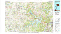
~ Keystone Lake OK topo map, 1:100000 scale, 30 X 60 Minute, Historical, 1990, updated 1990
Keystone Lake, Oklahoma, USGS topographic map dated 1990.
Includes geographic coordinates (latitude and longitude). This topographic map is suitable for hiking, camping, and exploring, or framing it as a wall map.
Printed on-demand using high resolution imagery, on heavy weight and acid free paper, or alternatively on a variety of synthetic materials.
Topos available on paper, Waterproof, Poly, or Tyvek. Usually shipping rolled, unless combined with other folded maps in one order.
- Product Number: USGS-5472759
- Free digital map download (high-resolution, GeoPDF): Keystone Lake, Oklahoma (file size: 28 MB)
- Map Size: please refer to the dimensions of the GeoPDF map above
- Weight (paper map): ca. 55 grams
- Map Type: POD USGS Topographic Map
- Map Series: HTMC
- Map Verison: Historical
- Cell ID: 67761
- Scan ID: 707152
- Imprint Year: 1990
- Woodland Tint: Yes
- Aerial Photo Year: 1981
- Edit Year: 1990
- Datum: NAD27
- Map Projection: Universal Transverse Mercator
- Map published by United States Geological Survey
- Map Language: English
- Scanner Resolution: 508 dpi
- Map Cell Name: Keystone Lake
- Grid size: 30 X 60 Minute
- Date on map: 1990
- Map Scale: 1:100000
- Geographical region: Oklahoma, United States
Neighboring Maps:
All neighboring USGS topo maps are available for sale online at a variety of scales.
Spatial coverage:
Topo map Keystone Lake, Oklahoma, covers the geographical area associated the following places:
- Oakhurst - Prattville - Lela - Maramec - Fisher - Pemeta - Osage - Terlton - Carbondale - Glencoe - Lawrence Creek - Oilton - Garden City - Leander - Gray - Shady Grove - Amabel - Bowden - Timberlane - Lake - Ripley - Prue - Oakridge - Skiatook - Wes - Indian Village - Avant - Jennings - Wekiwa - New Mannford - Gano - Shirk - Cedar Ridge - Masham - Skedee - Cartoco - Cody - Rigsby - Ingalls - Calida - Leroy - Morgans Corner - Mule Barn - Esau Junction - Price - Markham - Casey - Kengle - Peterman Ridge - Blackburn - Jobes - New Prue - Curchece - West Tulsa - Pawnee - Hominy - Rambo - Mehan - Rabornville - West Point - Westport - Lotsee - Jubys - Schlegel - Mannford - Hilton - Cleveland - Sha-To-She - Olive - Silver City - Frey - Quay - Watchorn - Empy - Player - Baugh - Yale - Hallett - Lone Chimney (historical) - Oak Grove - Red Fork - Sand Springs
- Map Area ID: AREA36.536-97-96
- Northwest corner Lat/Long code: USGSNW36.5-97
- Northeast corner Lat/Long code: USGSNE36.5-96
- Southwest corner Lat/Long code: USGSSW36-97
- Southeast corner Lat/Long code: USGSSE36-96
- Northern map edge Latitude: 36.5
- Southern map edge Latitude: 36
- Western map edge Longitude: -97
- Eastern map edge Longitude: -96


