
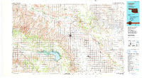
~ Fairview OK topo map, 1:100000 scale, 30 X 60 Minute, Historical, 1986, updated 1990
Fairview, Oklahoma, USGS topographic map dated 1986.
Includes geographic coordinates (latitude and longitude). This topographic map is suitable for hiking, camping, and exploring, or framing it as a wall map.
Printed on-demand using high resolution imagery, on heavy weight and acid free paper, or alternatively on a variety of synthetic materials.
Topos available on paper, Waterproof, Poly, or Tyvek. Usually shipping rolled, unless combined with other folded maps in one order.
- Product Number: USGS-5472745
- Free digital map download (high-resolution, GeoPDF): Fairview, Oklahoma (file size: 22 MB)
- Map Size: please refer to the dimensions of the GeoPDF map above
- Weight (paper map): ca. 55 grams
- Map Type: POD USGS Topographic Map
- Map Series: HTMC
- Map Verison: Historical
- Cell ID: 67500
- Scan ID: 707145
- Imprint Year: 1990
- Woodland Tint: Yes
- Aerial Photo Year: 1981
- Edit Year: 1986
- Datum: NAD27
- Map Projection: Universal Transverse Mercator
- Map published by United States Geological Survey
- Map Language: English
- Scanner Resolution: 508 dpi
- Map Cell Name: Fairview
- Grid size: 30 X 60 Minute
- Date on map: 1986
- Map Scale: 1:100000
- Geographical region: Oklahoma, United States
Neighboring Maps:
All neighboring USGS topo maps are available for sale online at a variety of scales.
Spatial coverage:
Topo map Fairview, Oklahoma, covers the geographical area associated the following places:
- Fonda - Hucmac - Homestead - Cedar Springs - Phroso - Drummond - Togo - Carleton - Orion - Canton - Lindley - Seiling - Okeene - Bouse Junction - Orienta - West Cleo - Carwile - Piper - Barr - Southard - Chester - Cheyenne Valley - Isabella - Cato - Meno - Ringwood - Cleo Springs - Lacey - Cedardale - Dane - Lahoma - Taloga - Ames - Darrow - Bado - Carrier - Fairview - Carlton - Parvin - Longdale - Belva - Crystal Lakes
- Map Area ID: AREA36.536-99-98
- Northwest corner Lat/Long code: USGSNW36.5-99
- Northeast corner Lat/Long code: USGSNE36.5-98
- Southwest corner Lat/Long code: USGSSW36-99
- Southeast corner Lat/Long code: USGSSE36-98
- Northern map edge Latitude: 36.5
- Southern map edge Latitude: 36
- Western map edge Longitude: -99
- Eastern map edge Longitude: -98


