
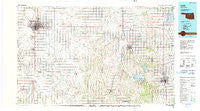
~ Enid OK topo map, 1:100000 scale, 30 X 60 Minute, Historical, 1990, updated 1990
Enid, Oklahoma, USGS topographic map dated 1990.
Includes geographic coordinates (latitude and longitude). This topographic map is suitable for hiking, camping, and exploring, or framing it as a wall map.
Printed on-demand using high resolution imagery, on heavy weight and acid free paper, or alternatively on a variety of synthetic materials.
Topos available on paper, Waterproof, Poly, or Tyvek. Usually shipping rolled, unless combined with other folded maps in one order.
- Product Number: USGS-5472741
- Free digital map download (high-resolution, GeoPDF): Enid, Oklahoma (file size: 22 MB)
- Map Size: please refer to the dimensions of the GeoPDF map above
- Weight (paper map): ca. 55 grams
- Map Type: POD USGS Topographic Map
- Map Series: HTMC
- Map Verison: Historical
- Cell ID: 67480
- Scan ID: 707143
- Imprint Year: 1990
- Woodland Tint: Yes
- Aerial Photo Year: 1981
- Edit Year: 1990
- Datum: NAD27
- Map Projection: Universal Transverse Mercator
- Map published by United States Geological Survey
- Map Language: English
- Scanner Resolution: 508 dpi
- Map Cell Name: Enid
- Grid size: 30 X 60 Minute
- Date on map: 1990
- Map Scale: 1:100000
- Geographical region: Oklahoma, United States
Neighboring Maps:
All neighboring USGS topo maps are available for sale online at a variety of scales.
Spatial coverage:
Topo map Enid, Oklahoma, covers the geographical area associated the following places:
- Blanton - Perry - Lovell - Covington - Enid - Buffalo Springs Stage Station (historical) - Yost - Red Rock - Hennessey - Marshall - Ituna - Callahan - Union - Bison - Drace - Fairmont - Cropper - North Enid - Petes Corner - Jonah - Marena - Otoe - Imo - Sumner - Garber - Waukomis - Stillwater - Jacks - Douglas - Orlando - Lucien - Breckinridge - Hayward - Mulhall - Shea - Gansel - Roxana - McMahon - Bills Corner - Morrison - Ceres - Black Bear - Etna - Midway
- Map Area ID: AREA36.536-98-97
- Northwest corner Lat/Long code: USGSNW36.5-98
- Northeast corner Lat/Long code: USGSNE36.5-97
- Southwest corner Lat/Long code: USGSSW36-98
- Southeast corner Lat/Long code: USGSSE36-97
- Northern map edge Latitude: 36.5
- Southern map edge Latitude: 36
- Western map edge Longitude: -98
- Eastern map edge Longitude: -97


