
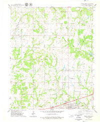
~ Stroud North OK topo map, 1:24000 scale, 7.5 X 7.5 Minute, Historical, 1975, updated 1979
Stroud North, Oklahoma, USGS topographic map dated 1975.
Includes geographic coordinates (latitude and longitude). This topographic map is suitable for hiking, camping, and exploring, or framing it as a wall map.
Printed on-demand using high resolution imagery, on heavy weight and acid free paper, or alternatively on a variety of synthetic materials.
Topos available on paper, Waterproof, Poly, or Tyvek. Usually shipping rolled, unless combined with other folded maps in one order.
- Product Number: USGS-5471743
- Free digital map download (high-resolution, GeoPDF): Stroud North, Oklahoma (file size: 8 MB)
- Map Size: please refer to the dimensions of the GeoPDF map above
- Weight (paper map): ca. 55 grams
- Map Type: POD USGS Topographic Map
- Map Series: HTMC
- Map Verison: Historical
- Cell ID: 43520
- Scan ID: 706886
- Imprint Year: 1979
- Woodland Tint: Yes
- Aerial Photo Year: 1974
- Field Check Year: 1975
- Datum: NAD27
- Map Projection: Lambert Conformal Conic
- Map published by United States Geological Survey
- Map Language: English
- Scanner Resolution: 508 dpi
- Map Cell Name: Stroud North
- Grid size: 7.5 X 7.5 Minute
- Date on map: 1975
- Map Scale: 1:24000
- Geographical region: Oklahoma, United States
Neighboring Maps:
All neighboring USGS topo maps are available for sale online at a variety of scales.
Spatial coverage:
Topo map Stroud North, Oklahoma, covers the geographical area associated the following places:
- Stroud Middle School - Tanger Factory Outlet Center - First Church of the Nazarene - City of Stroud - Oknoname 08109 Dam - Township of North Keokuk - Oknoname 08109 Reservoir - Stroud Interchange - Black Cemetery - Parkview Elementary School - Lilly Creek - Plaza 66 - Stroud Elementary School - First Baptist Church - Stroud Sewage Lagoon - Stroud Municipal Airport - Chapel of Faith Church - Stroud High School - Northeast Lincoln Division - Henry Cemetery - Stroud Sewage Lagoon Dam
- Map Area ID: AREA35.87535.75-96.75-96.625
- Northwest corner Lat/Long code: USGSNW35.875-96.75
- Northeast corner Lat/Long code: USGSNE35.875-96.625
- Southwest corner Lat/Long code: USGSSW35.75-96.75
- Southeast corner Lat/Long code: USGSSE35.75-96.625
- Northern map edge Latitude: 35.875
- Southern map edge Latitude: 35.75
- Western map edge Longitude: -96.75
- Eastern map edge Longitude: -96.625


