
~ Stigler NE OK topo map, 1:24000 scale, 7.5 X 7.5 Minute, Historical, 1963, updated 1979
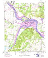
Stigler NE, Oklahoma, USGS topographic map dated 1963.
Includes geographic coordinates (latitude and longitude). This topographic map is suitable for hiking, camping, and exploring, or framing it as a wall map.
Printed on-demand using high resolution imagery, on heavy weight and acid free paper, or alternatively on a variety of synthetic materials.
Topos available on paper, Waterproof, Poly, or Tyvek. Usually shipping rolled, unless combined with other folded maps in one order.
- Product Number: USGS-5471681
- Free digital map download (high-resolution, GeoPDF): Stigler NE, Oklahoma (file size: 11 MB)
- Map Size: please refer to the dimensions of the GeoPDF map above
- Weight (paper map): ca. 55 grams
- Map Type: POD USGS Topographic Map
- Map Series: HTMC
- Map Verison: Historical
- Cell ID: 43199
- Scan ID: 706859
- Imprint Year: 1979
- Woodland Tint: Yes
- Photo Revision Year: 1979
- Aerial Photo Year: 1973
- Edit Year: 1979
- Field Check Year: 1963
- Datum: NAD27
- Map Projection: Polyconic
- Map published by United States Geological Survey
- Map Language: English
- Scanner Resolution: 508 dpi
- Map Cell Name: Stigler NE
- Grid size: 7.5 X 7.5 Minute
- Date on map: 1963
- Map Scale: 1:24000
- Geographical region: Oklahoma, United States
Neighboring Maps:
All neighboring USGS topo maps are available for sale online at a variety of scales.
Spatial coverage:
Topo map Stigler NE, Oklahoma, covers the geographical area associated the following places:
- Stony Point Church - Hefley Cemetery - McIntosh Chapel - Township of Liberty - Harris Mountain - Upper Sandtown Bottom - Hisaw Bottom - Dirty Creek - Starr Cemetery - Upson Siding - Webbers Falls (historical) - Hanks Cemetery - Negro Creek - Wilkerson Cemetery - Oknoname 111032 Dam - Round Mountain Cemetery - Sally Jones Lake - Foreman Cemetery - Round Mountain Church - Jones Cemetery - Kyle Cemetery - Carlile Cemetery - Illinois River - Round Mountain - Oknoname 111032 Reservoir - Brier Creek - Wilkerson Cemetery - Vann Cemetery - Sandtown Cemetery - Girty Cemetery - Canadian River - Sequoyah National Wildlife Refuge - Clark Cemetery - Fields Cemetery - Rock Hill Church - Toney Cemetery - Red Hill Cemetery - Town of Tamaha
- Map Area ID: AREA35.535.375-95.125-95
- Northwest corner Lat/Long code: USGSNW35.5-95.125
- Northeast corner Lat/Long code: USGSNE35.5-95
- Southwest corner Lat/Long code: USGSSW35.375-95.125
- Southeast corner Lat/Long code: USGSSE35.375-95
- Northern map edge Latitude: 35.5
- Southern map edge Latitude: 35.375
- Western map edge Longitude: -95.125
- Eastern map edge Longitude: -95


