
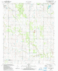
~ Post Oak Creek OK topo map, 1:24000 scale, 7.5 X 7.5 Minute, Historical, 1991, updated 1992
Post Oak Creek, Oklahoma, USGS topographic map dated 1991.
Includes geographic coordinates (latitude and longitude). This topographic map is suitable for hiking, camping, and exploring, or framing it as a wall map.
Printed on-demand using high resolution imagery, on heavy weight and acid free paper, or alternatively on a variety of synthetic materials.
Topos available on paper, Waterproof, Poly, or Tyvek. Usually shipping rolled, unless combined with other folded maps in one order.
- Product Number: USGS-5471137
- Free digital map download (high-resolution, GeoPDF): Post Oak Creek, Oklahoma (file size: 9 MB)
- Map Size: please refer to the dimensions of the GeoPDF map above
- Weight (paper map): ca. 55 grams
- Map Type: POD USGS Topographic Map
- Map Series: HTMC
- Map Verison: Historical
- Cell ID: 71286
- Scan ID: 706597
- Imprint Year: 1992
- Woodland Tint: Yes
- Aerial Photo Year: 1987
- Edit Year: 1991
- Field Check Year: 1987
- Datum: NAD27
- Map Projection: Lambert Conformal Conic
- Map published by United States Geological Survey
- Map Language: English
- Scanner Resolution: 600 dpi
- Map Cell Name: Post Oak Creek
- Grid size: 7.5 X 7.5 Minute
- Date on map: 1991
- Map Scale: 1:24000
- Geographical region: Oklahoma, United States
Neighboring Maps:
All neighboring USGS topo maps are available for sale online at a variety of scales.
Spatial coverage:
Topo map Post Oak Creek, Oklahoma, covers the geographical area associated the following places:
- Oknoname 031020 Dam - Comanche Tribal Cultural Center - Cache Indian Cemetery - Nazarine Indian Mission (historical) - Oknoname 031019 Reservoir - Oknoname 031020 Reservoir - Oknoname 031021 Reservoir - Oknoname 031018 Dam - Cache Intermediate Elementary School - Oknoname 031021 Dam - Oknoname 031019 Dam - Cache High School - Little Post Oak Creek - Cache Middle School - Oknoname 031018 Reservoir - Cache Indian Church of the Nazarine - Sandy Creek - Rock Creek - Township of Painter - Cache Primary Elementary School
- Map Area ID: AREA34.62534.5-98.75-98.625
- Northwest corner Lat/Long code: USGSNW34.625-98.75
- Northeast corner Lat/Long code: USGSNE34.625-98.625
- Southwest corner Lat/Long code: USGSSW34.5-98.75
- Southeast corner Lat/Long code: USGSSE34.5-98.625
- Northern map edge Latitude: 34.625
- Southern map edge Latitude: 34.5
- Western map edge Longitude: -98.75
- Eastern map edge Longitude: -98.625


