
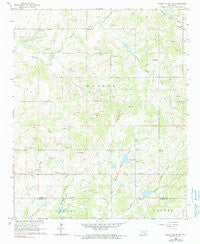
~ Pauls Valley NE OK topo map, 1:24000 scale, 7.5 X 7.5 Minute, Historical, 1965, updated 1990
Pauls Valley NE, Oklahoma, USGS topographic map dated 1965.
Includes geographic coordinates (latitude and longitude). This topographic map is suitable for hiking, camping, and exploring, or framing it as a wall map.
Printed on-demand using high resolution imagery, on heavy weight and acid free paper, or alternatively on a variety of synthetic materials.
Topos available on paper, Waterproof, Poly, or Tyvek. Usually shipping rolled, unless combined with other folded maps in one order.
- Product Number: USGS-5471031
- Free digital map download (high-resolution, GeoPDF): Pauls Valley NE, Oklahoma (file size: 10 MB)
- Map Size: please refer to the dimensions of the GeoPDF map above
- Weight (paper map): ca. 55 grams
- Map Type: POD USGS Topographic Map
- Map Series: HTMC
- Map Verison: Historical
- Cell ID: 34448
- Scan ID: 706547
- Imprint Year: 1990
- Woodland Tint: Yes
- Photo Inspection Year: 1978
- Aerial Photo Year: 1962
- Field Check Year: 1965
- Datum: NAD27
- Map Projection: Polyconic
- Map published by United States Geological Survey
- Map Language: English
- Scanner Resolution: 600 dpi
- Map Cell Name: Pauls Valley NE
- Grid size: 7.5 X 7.5 Minute
- Date on map: 1965
- Map Scale: 1:24000
- Geographical region: Oklahoma, United States
Neighboring Maps:
All neighboring USGS topo maps are available for sale online at a variety of scales.
Spatial coverage:
Topo map Pauls Valley NE, Oklahoma, covers the geographical area associated the following places:
- Cherokee Sandy Site 8 Dam - New Hope School - Cherokee Sandy Site 2 Dam - Willow Sandy Creek - Stratford Division - Chigley Sandy Creek Site 6 Dam - Sandy Hill Cemetery - Kickapoo Sandy Creek Site N3b Dam - Cherokee Sandy Site 9 Reservoir - Kickapoo Sandy Creek Site N3b Reservoir - Kickapoo Sandy Creek Site N3a Reservoir - Chigley Sandy Creek Site 6 Reservoir - Walker Church - Rock Creek Site 1 Dam - Chigley Sandy Creek Site 3 Reservoir - Cherokee Sandy Site 2 Reservoir - Chigley Sandy Creek Site 4 Dam - Southwest Lewis Oil Field - Cherokee Sandy Site 15 Dam - Lewis Oil Field - Cherokee Sandy Site 14 Reservoir - Mount Zion Church - East Pauls Valley Oil Field - Cherokee Sandy Site 1 Dam - Kickapoo Sandy Creek Site N3a Dam - Cherokee Sandy Site 9 Dam - Cherokee Sandy Site 8 Reservoir - Sandy Hill Church - Oak Dale School - Cherokee Sandy Site 15 Reservoir - Chigley Sandy Creek Site 5 Reservoir - Cherokee Sandy Site 10 Dam - Kickapoo Sandy Creek Site N2 Dam - Keel Sandy Creek - Cherokee Sandy Site 1 Reservoir - Walker School - Northeast Nahola Oil Field - Chigley Sandy Creek Site 4 Reservoir - Township of Walker - Walker Fire District - Kickapoo Sandy Creek Site N2 Reservoir - Cherokee Sandy Site 14 Dam - Rock Creek Site 1 Reservoir - Oak Grove Cemetery - Lewis Cemetery - Cherokee Sandy Site 10 Reservoir - Chigley Snady Creek Site 3 Dam - Chigley Sandy Creek Site 5 Dam - Cottrells Mission
- Map Area ID: AREA34.7534.625-97.125-97
- Northwest corner Lat/Long code: USGSNW34.75-97.125
- Northeast corner Lat/Long code: USGSNE34.75-97
- Southwest corner Lat/Long code: USGSSW34.625-97.125
- Southeast corner Lat/Long code: USGSSE34.625-97
- Northern map edge Latitude: 34.75
- Southern map edge Latitude: 34.625
- Western map edge Longitude: -97.125
- Eastern map edge Longitude: -97


