
~ Ninemile Creek OK topo map, 1:24000 scale, 7.5 X 7.5 Minute, Historical, 1956, updated 1976
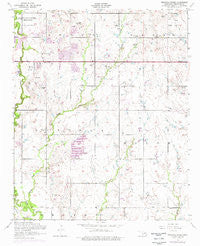
Ninemile Creek, Oklahoma, USGS topographic map dated 1956.
Includes geographic coordinates (latitude and longitude). This topographic map is suitable for hiking, camping, and exploring, or framing it as a wall map.
Printed on-demand using high resolution imagery, on heavy weight and acid free paper, or alternatively on a variety of synthetic materials.
Topos available on paper, Waterproof, Poly, or Tyvek. Usually shipping rolled, unless combined with other folded maps in one order.
- Product Number: USGS-5470857
- Free digital map download (high-resolution, GeoPDF): Ninemile Creek, Oklahoma (file size: 9 MB)
- Map Size: please refer to the dimensions of the GeoPDF map above
- Weight (paper map): ca. 55 grams
- Map Type: POD USGS Topographic Map
- Map Series: HTMC
- Map Verison: Historical
- Cell ID: 32124
- Scan ID: 706456
- Imprint Year: 1976
- Woodland Tint: Yes
- Photo Revision Year: 1975
- Aerial Photo Year: 1975
- Field Check Year: 1956
- Datum: NAD27
- Map Projection: Polyconic
- Map published by United States Geological Survey
- Map published by United States Army Corps of Engineers
- Map published by United States Army
- Map Language: English
- Scanner Resolution: 600 dpi
- Map Cell Name: Ninemile Creek
- Grid size: 7.5 X 7.5 Minute
- Date on map: 1956
- Map Scale: 1:24000
- Geographical region: Oklahoma, United States
Neighboring Maps:
All neighboring USGS topo maps are available for sale online at a variety of scales.
Spatial coverage:
Topo map Ninemile Creek, Oklahoma, covers the geographical area associated the following places:
- Township of Lincoln - KKRX-AM (Lawton) - Oknoname 031055 Dam - Oknoname 031014 Reservoir - KKRX-FM (Lawton) - R and D Aviation Landing Strip (historical) - MacArthur High School - KVRW-FM (Lawton) - Oknoname 031053 Dam - Lawton Correctional Facility - Carriage Hills Church - Flower Mound Community Cemetery - MacArthur Middle School - Ninemile Creek - Flower Mound Elementary School - KCCU-FM (Lawton) - Flower Mound Volunteer Fire Department - Oknoname 031058 Dam - Sullivan Village Elementary School - DJs Airport - Hill Top Private Airport - Skyline Missionary Baptist Church - Lawton Downs - Church of Christ-Sullivan Village - Trinity Assembly of God Church - Oknoname 031053 Reservoir - East Church - Oknoname 031055 Reservoir - Oknoname 031059 Dam - Church of Christ - Jehovahs Witnesses East Congregation - Oknoname 031014 Dam - Carriage Hills Elementary School - Oknoname 031033 Dam - Aldersgate Church - KSWO-AM (Lawton) - Lawton Fire Department Station 6 - Southeast Comanche Division - Cornerstone Fellowship Church - Oknoname 031033 Reservoir - Oknoname 031058 Reservoir - Oknoname 031054 Dam - Oknoname 031054 Reservoir - Oknoname 031059 Reservoir - KTDA-TV (Lawton) - Park Lane Elementary School
- Map Area ID: AREA34.62534.5-98.375-98.25
- Northwest corner Lat/Long code: USGSNW34.625-98.375
- Northeast corner Lat/Long code: USGSNE34.625-98.25
- Southwest corner Lat/Long code: USGSSW34.5-98.375
- Southeast corner Lat/Long code: USGSSE34.5-98.25
- Northern map edge Latitude: 34.625
- Southern map edge Latitude: 34.5
- Western map edge Longitude: -98.375
- Eastern map edge Longitude: -98.25


