
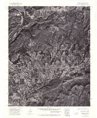
~ Hulbert SW OK topo map, 1:24000 scale, 7.5 X 7.5 Minute, Historical, 1972, updated 1974
Hulbert SW, Oklahoma, USGS topographic map dated 1972.
Includes geographic coordinates (latitude and longitude). This topographic map is suitable for hiking, camping, and exploring, or framing it as a wall map.
Printed on-demand using high resolution imagery, on heavy weight and acid free paper, or alternatively on a variety of synthetic materials.
Topos available on paper, Waterproof, Poly, or Tyvek. Usually shipping rolled, unless combined with other folded maps in one order.
- Product Number: USGS-5470081
- Free digital map download (high-resolution, GeoPDF): Hulbert SW, Oklahoma (file size: 17 MB)
- Map Size: please refer to the dimensions of the GeoPDF map above
- Weight (paper map): ca. 55 grams
- Map Type: POD USGS Topographic Map
- Map Series: HTMC
- Map Verison: Historical
- Cell ID: 15908
- Scan ID: 706093
- Imprint Year: 1974
- Aerial Photo Year: 1972
- Datum: NAD27
- Map Projection: Lambert Conformal Conic
- Orthophoto: Quad
- Map published by United States Geological Survey
- Keywords: Nonstandard Press Run
- Map Language: English
- Scanner Resolution: 508 dpi
- Map Cell Name: Fort Gibson Dam
- Grid size: 7.5 X 7.5 Minute
- Date on map: 1972
- Map Scale: 1:24000
- Geographical region: Oklahoma, United States
Neighboring Maps:
All neighboring USGS topo maps are available for sale online at a variety of scales.
Spatial coverage:
Topo map Hulbert SW, Oklahoma, covers the geographical area associated the following places:
- Fort Gibson Lake - Fort Gibson Intermediate Elementary School - Sugar Hollow - Fort Gibson Dam - Canyon Road Public Use Area - Kale Dick Hollow - Four Mile Cemetery - Andersons Cemetery - Braggs Mountain - McGee Hollow - Fourmile Branch - Walker Cemetery - Spurlop Mountain - Blackberry Hill - Walker Branch - Deadman Hollow - Sleeper Hollow - Norwood Fire Department Station 1 - Starnes Cemetery - Cedar Hollow - Norwood Lakeview Church - Fort Gibson Middle School - Hicks Branch - Fort Gibson Citizen's Cemetery - Whiskey Hollow - Dripping Spring Hollow - Limestone Hollow - Lucy Albirdie Flat - Anderson Cemetery - Norwood Elementary School - Dam Site Public Use Area - Iron Spring Hollow - Fourmile Branch Church - Buzzard Hollow - Fort Gibson High School - Fort Gibson Early Learning Center - Boughtman Hollow - Flower Creek - Runnels Mountain - Fort Gibson National Cemetery - Township of Nash - Fourteenmile Creek
- Map Area ID: AREA35.87535.75-95.25-95.125
- Northwest corner Lat/Long code: USGSNW35.875-95.25
- Northeast corner Lat/Long code: USGSNE35.875-95.125
- Southwest corner Lat/Long code: USGSSW35.75-95.25
- Southeast corner Lat/Long code: USGSSE35.75-95.125
- Northern map edge Latitude: 35.875
- Southern map edge Latitude: 35.75
- Western map edge Longitude: -95.25
- Eastern map edge Longitude: -95.125


