
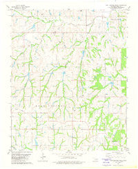
~ East Roaring Creek OK topo map, 1:24000 scale, 7.5 X 7.5 Minute, Historical, 1981, updated 1982
East Roaring Creek, Oklahoma, USGS topographic map dated 1981.
Includes geographic coordinates (latitude and longitude). This topographic map is suitable for hiking, camping, and exploring, or framing it as a wall map.
Printed on-demand using high resolution imagery, on heavy weight and acid free paper, or alternatively on a variety of synthetic materials.
Topos available on paper, Waterproof, Poly, or Tyvek. Usually shipping rolled, unless combined with other folded maps in one order.
- Product Number: USGS-5469477
- Free digital map download (high-resolution, GeoPDF): East Roaring Creek, Oklahoma (file size: 9 MB)
- Map Size: please refer to the dimensions of the GeoPDF map above
- Weight (paper map): ca. 55 grams
- Map Type: POD USGS Topographic Map
- Map Series: HTMC
- Map Verison: Historical
- Cell ID: 13483
- Scan ID: 705786
- Imprint Year: 1982
- Woodland Tint: Yes
- Aerial Photo Year: 1974
- Edit Year: 1981
- Field Check Year: 1977
- Datum: NAD27
- Map Projection: Lambert Conformal Conic
- Map published by United States Geological Survey
- Map Language: English
- Scanner Resolution: 508 dpi
- Map Cell Name: East Roaring Creek
- Grid size: 7.5 X 7.5 Minute
- Date on map: 1981
- Map Scale: 1:24000
- Geographical region: Oklahoma, United States
Neighboring Maps:
All neighboring USGS topo maps are available for sale online at a variety of scales.
Spatial coverage:
Topo map East Roaring Creek, Oklahoma, covers the geographical area associated the following places:
- Round Creek Site 8 Reservoir - Middle Roaring Creek - Roaring Creek Site 7 Reservoir - Roaring Creek Site 12 Dam - Roaring Creek Site 3 Reservoir - Roaring Creek Site 13 Dam - Roaring Creek Site 7 Dam - Roaring Creek Site 16 Dam - Round Creek Site 8 Dam - Roaring Creek Site 2 Dam - Chitwood - Roaring Creek Site 4 Dam - Chitwood School - Round Creek Site 7 Dam - Rush Creek Site 7 Dam - Roaring Creek Site 5 Reservoir - Slayton School - Pea Ridge School - Roaring Creek Site 2 Reservoir - Roaring Creek Site 16 Reservoir - Vimy Ridge Church - Roaring Creek Site 3 Dam - Round Creek Site 7 Reservoir - East Roaring Creek - Roaring Creek Site 1 Reservoir - Oknoname 051061 Dam - Oknoname 051061 Reservoir - Grady County Fire Department Cox City Station - Roaring Creek Site 13 Reservoir - Sandy Grove School - Rush Creek Site 9 Dam - Roaring Creek Site 12 Reservoir - Oknoname 051060 Reservoir - Roaring Creek Site 14 Dam - Vimy Ridge School - Oknoname 051060 Dam - Roaring Creek Site 5 Dam - Roaring Creek Site 8 Dam - Rush Creek Site 9 Reservoir - Roaring Creek Site 8 Reservoir - Roaring Creek Site 1 Dam - Roaring Creek Site 14 Reservoir - Roaring Creek Site 11 Dam - Roaring Creek Site 4 Reservoir - Rush Creek Site 7 Reservoir - Pleasant View School - Roaring Creek Site 11 Reservoir
- Map Area ID: AREA34.87534.75-97.875-97.75
- Northwest corner Lat/Long code: USGSNW34.875-97.875
- Northeast corner Lat/Long code: USGSNE34.875-97.75
- Southwest corner Lat/Long code: USGSSW34.75-97.875
- Southeast corner Lat/Long code: USGSSE34.75-97.75
- Northern map edge Latitude: 34.875
- Southern map edge Latitude: 34.75
- Western map edge Longitude: -97.875
- Eastern map edge Longitude: -97.75


