
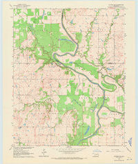
~ Catoosa SE OK topo map, 1:24000 scale, 7.5 X 7.5 Minute, Historical, 1963, updated 1971
Catoosa SE, Oklahoma, USGS topographic map dated 1963.
Includes geographic coordinates (latitude and longitude). This topographic map is suitable for hiking, camping, and exploring, or framing it as a wall map.
Printed on-demand using high resolution imagery, on heavy weight and acid free paper, or alternatively on a variety of synthetic materials.
Topos available on paper, Waterproof, Poly, or Tyvek. Usually shipping rolled, unless combined with other folded maps in one order.
- Product Number: USGS-5469041
- Free digital map download (high-resolution, GeoPDF): Catoosa SE, Oklahoma (file size: 7 MB)
- Map Size: please refer to the dimensions of the GeoPDF map above
- Weight (paper map): ca. 55 grams
- Map Type: POD USGS Topographic Map
- Map Series: HTMC
- Map Verison: Historical
- Cell ID: 7686
- Scan ID: 800809
- Imprint Year: 1971
- Woodland Tint: Yes
- Aerial Photo Year: 1962
- Field Check Year: 1963
- Datum: NAD27
- Map Projection: Polyconic
- Map published by United States Geological Survey
- Map Language: English
- Scanner Resolution: 508 dpi
- Map Cell Name: Catoosa SE
- Grid size: 7.5 X 7.5 Minute
- Date on map: 1963
- Map Scale: 1:24000
- Geographical region: Oklahoma, United States
Neighboring Maps:
All neighboring USGS topo maps are available for sale online at a variety of scales.
Spatial coverage:
Topo map Catoosa SE, Oklahoma, covers the geographical area associated the following places:
- Childers Cemetery - Oknoname 131015 Dam - Friendship Church - Runaround Lake - Bluegill Point Public Use Area - Willow Spring Church - Newt Graham Lock and Dam - Lock and Dam 18 - Channel View Public Use Area - Pecan Slough - Goodhope Bottom - Newt Graham Lock and Dam 18 - Flagg Lake - Little Long Lake - Old Channel Verdigris River - Pea Creek - Town of Inola - Brushy Prairie - Inola Creek - Adams Creek - Big Bottom - Goodhope Ramp Public Use Area - Newt Graham Lake - Thomas Church - Bluff Landing Public Use Area - Guinn Bottom - Long Lake - Township of Coal Creek - Oknoname 131015 Reservoir - Lone Star Church - Snake Den Lake - Legas Lake - Snake Den Bluff
- Map Area ID: AREA36.12536-95.625-95.5
- Northwest corner Lat/Long code: USGSNW36.125-95.625
- Northeast corner Lat/Long code: USGSNE36.125-95.5
- Southwest corner Lat/Long code: USGSSW36-95.625
- Southeast corner Lat/Long code: USGSSE36-95.5
- Northern map edge Latitude: 36.125
- Southern map edge Latitude: 36
- Western map edge Longitude: -95.625
- Eastern map edge Longitude: -95.5


