
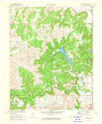
~ Bowring SE OK topo map, 1:24000 scale, 7.5 X 7.5 Minute, Historical, 1971, updated 1973
Bowring SE, Oklahoma, USGS topographic map dated 1971.
Includes geographic coordinates (latitude and longitude). This topographic map is suitable for hiking, camping, and exploring, or framing it as a wall map.
Printed on-demand using high resolution imagery, on heavy weight and acid free paper, or alternatively on a variety of synthetic materials.
Topos available on paper, Waterproof, Poly, or Tyvek. Usually shipping rolled, unless combined with other folded maps in one order.
- Product Number: USGS-5468861
- Free digital map download (high-resolution, GeoPDF): Bowring SE, Oklahoma (file size: 10 MB)
- Map Size: please refer to the dimensions of the GeoPDF map above
- Weight (paper map): ca. 55 grams
- Map Type: POD USGS Topographic Map
- Map Series: HTMC
- Map Verison: Historical
- Cell ID: 5093
- Scan ID: 705474
- Imprint Year: 1973
- Woodland Tint: Yes
- Aerial Photo Year: 1971
- Field Check Year: 1971
- Datum: NAD27
- Map Projection: Polyconic
- Map published by United States Geological Survey
- Map Language: English
- Scanner Resolution: 508 dpi
- Map Cell Name: Bowring SE
- Grid size: 7.5 X 7.5 Minute
- Date on map: 1971
- Map Scale: 1:24000
- Geographical region: Oklahoma, United States
Neighboring Maps:
All neighboring USGS topo maps are available for sale online at a variety of scales.
Spatial coverage:
Topo map Bowring SE, Oklahoma, covers the geographical area associated the following places:
- Oknoname 113042 Dam - Oknoname 113023 Reservoir - Lake Hudson - Oknoname 113021 Reservoir - Oknoname 113041 Reservoir - Oknoname 113037 Reservoir - Bar-Dew Dam - Oknoname 113025 Reservoir - Oknoname 113043 Dam - Oknoname 113043 Reservoir - Oknoname 113074 Dam - Oknoname 113019 Reservoir - Oknoname 113045 Reservoir - Oknoname 113047 Dam - Oknoname 113046 Reservoir - Oknoname 113019 Dam - Cotton-Coon-Mission Creek Site 1 Dam - Oknoname 113036 Dam - Camp Creek - Oknoname 113074 Reservoir - Oknoname 113037 Reservoir - The Mound - Oknoname 113048 Dam - Oknoname 113045 Dam - Oknoname 113038 Dam - Bartlesville Municipal Airport - Oknoname 113044 Reservoir - Oknoname 113023 Dam - Oknoname 113049 Dam - Oknoname 113040 Dam - Oknoname 113048 Reservoir - Oknoname 113047 Reservoir - Oknoname 113041 Dam - Oknoname 113039 Reservoir - Hudson Dam - Oknoname 113037 Dam - Bar-Dew Lake - Oknoname 113020 Reservoir - Bartlesville Air Force Station (historical) - Oknoname 113038 Reservoir - Oknoname 113024 Dam - Oknoname 113024 Reservoir - Oknoname 113025 Dam - Oknoname 113037 Dam - Oknoname 113075 Reservoir - Oknoname 113049 Reservoir - Oknoname 113076 Reservoir - Oknoname 113044 Dam - Cedar Creek - Oknoname 113076 Dam - Oknoname 113040 Reservoir - Oak Park Baptist Church - Oknoname 113022 Reservoir - Oknoname 113042 Reservoir - Oknoname 113039 Dam - Cotton-Coon-Mission Creek Site 1 Reservoir - Sunset Country Club - Mission Creek - Oknoname 113075 Dam - Oknoname 113020 Dam - Oknoname 113022 Dam - Oknoname 113021 Dam - Oknoname 113046 Dam - Oknoname 113036 Reservoir
- Map Area ID: AREA36.87536.75-96.125-96
- Northwest corner Lat/Long code: USGSNW36.875-96.125
- Northeast corner Lat/Long code: USGSNE36.875-96
- Southwest corner Lat/Long code: USGSSW36.75-96.125
- Southeast corner Lat/Long code: USGSSE36.75-96
- Northern map edge Latitude: 36.875
- Southern map edge Latitude: 36.75
- Western map edge Longitude: -96.125
- Eastern map edge Longitude: -96


