
~ Republic SW MI topo map, 1:24000 scale, 7.5 X 7.5 Minute, Historical, 2011
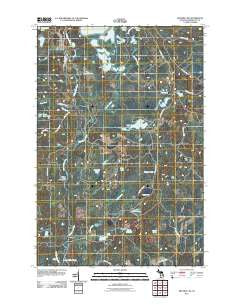
Republic SW, Michigan, USGS topographic map dated 2011.
Includes geographic coordinates (latitude and longitude). This topographic map is suitable for hiking, camping, and exploring, or framing it as a wall map.
Printed on-demand using high resolution imagery, on heavy weight and acid free paper, or alternatively on a variety of synthetic materials.
Topos available on paper, Waterproof, Poly, or Tyvek. Usually shipping rolled, unless combined with other folded maps in one order.
- Product Number: USGS-5467895
- Free digital map download (high-resolution, GeoPDF): Republic SW, Michigan (file size: 29 MB)
- Map Size: please refer to the dimensions of the GeoPDF map above
- Weight (paper map): ca. 55 grams
- Map Type: POD USGS Topographic Map
- Map Series: US Topo
- Map Verison: Historical
- Cell ID: 37642
- Datum: North American Datum of 1983
- Map Projection: Transverse Mercator
- Map Cell Name: Republic SW
- Grid size: 7.5 X 7.5 Minute
- Date on map: 2011
- Map Scale: 1:24000
- Geographical region: Michigan, United States
Neighboring Maps:
All neighboring USGS topo maps are available for sale online at a variety of scales.
Spatial coverage:
Topo map Republic SW, Michigan, covers the geographical area associated the following places:
- Beaver Lake - Twin Lakes - Caps Creek - Hot Jack Lake - Gambles Creek - Peterson Lake - Helen Lake - Bethany Lutheran Church - Chain of Lakes - Third Lake - Wahlstrom Lake - Porterfield Lake - Long Lake - Lake of The Plains - Bengston Lake - Big Lick Lake - Saint Clair Lake - Wilson Creek - Petcuson Lake - Donaldson Lake - Lustig Lake - Hermit Lake - Republic Michigamme Public Library - Casey Swamp - Bell Medical Family Practice - Just Lake - Loon Lake - Casey Lake - Sunson Lake - Witbeck Rapids Campground - First Baptist Church - Republic Michigamme School - Martells Lake
- Map Area ID: AREA46.37546.25-88-87.875
- Northwest corner Lat/Long code: USGSNW46.375-88
- Northeast corner Lat/Long code: USGSNE46.375-87.875
- Southwest corner Lat/Long code: USGSSW46.25-88
- Southeast corner Lat/Long code: USGSSE46.25-87.875
- Northern map edge Latitude: 46.375
- Southern map edge Latitude: 46.25
- Western map edge Longitude: -88
- Eastern map edge Longitude: -87.875


