
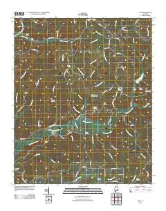
~ Vina AL topo map, 1:24000 scale, 7.5 X 7.5 Minute, Historical, 2011
Vina, Alabama, USGS topographic map dated 2011.
Includes geographic coordinates (latitude and longitude). This topographic map is suitable for hiking, camping, and exploring, or framing it as a wall map.
Printed on-demand using high resolution imagery, on heavy weight and acid free paper, or alternatively on a variety of synthetic materials.
Topos available on paper, Waterproof, Poly, or Tyvek. Usually shipping rolled, unless combined with other folded maps in one order.
- Product Number: USGS-5466197
- Free digital map download (high-resolution, GeoPDF): Vina, Alabama (file size: 25 MB)
- Map Size: please refer to the dimensions of the GeoPDF map above
- Weight (paper map): ca. 55 grams
- Map Type: POD USGS Topographic Map
- Map Series: US Topo
- Map Verison: Historical
- Cell ID: 46944
- Datum: North American Datum of 1983
- Map Projection: Transverse Mercator
- Map Cell Name: Vina
- Grid size: 7.5 X 7.5 Minute
- Date on map: 2011
- Map Scale: 1:24000
- Geographical region: Alabama, United States
Neighboring Maps:
All neighboring USGS topo maps are available for sale online at a variety of scales.
Spatial coverage:
Topo map Vina, Alabama, covers the geographical area associated the following places:
- Shottsville Cemetery - Miller Cemetery - Deer Lick Branch - Beaver Dam Branch - Bridge Branch - Brazel Cemetery - Childers Mill Branch - Fairview Church - Good Spring Church - Bluegut Creek - Single Spring Cemetery - Bethany Cemetery - Shottsville Methodist Church - Jones Cemetery - Deadman Branch - Newburg Cemetery - East Fork Mill Creek - Vina Division - Roberts Branch - Davis Cemetery - Hurricane Branch - Mobley Dam - Latchie Branch - Lane Branch - Mill Branch - Skirum Creek - Mill Creek - Nichols Cemetery - Bear Branch - Mule Stable Branch - Loyd Mill Branch - Bluegut Creek Gas Field - Nettles Branch - Good Spring - Lockridge Cemetery - Pilot Hill - Fairview Freewill Baptist Church - Dry Creek - Mobley Lake - West Fork Mill Creek - Lindsey Cemetery - Liberty Hill Cemetery - Liberty Hill Freewill Baptist Church - Little Bluegut Creek - Williams Sanctuary Church - Pilot Hill Cemetery - Moore Hill - Jim Branch - Fairview Cemetery - Pilot Hill Church - Childers Family Cemetery - Bethany Baptist Church - Round Top School (historical) - Good Spring - Turkey Creek - Holly Spring Branch - Single Spring Church - Single Spring Church - Mount Hope Church
- Map Area ID: AREA34.37534.25-88.125-88
- Northwest corner Lat/Long code: USGSNW34.375-88.125
- Northeast corner Lat/Long code: USGSNE34.375-88
- Southwest corner Lat/Long code: USGSSW34.25-88.125
- Southeast corner Lat/Long code: USGSSE34.25-88
- Northern map edge Latitude: 34.375
- Southern map edge Latitude: 34.25
- Western map edge Longitude: -88.125
- Eastern map edge Longitude: -88


