
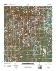
~ Theodore AL topo map, 1:24000 scale, 7.5 X 7.5 Minute, Historical, 2011
Theodore, Alabama, USGS topographic map dated 2011.
Includes geographic coordinates (latitude and longitude). This topographic map is suitable for hiking, camping, and exploring, or framing it as a wall map.
Printed on-demand using high resolution imagery, on heavy weight and acid free paper, or alternatively on a variety of synthetic materials.
Topos available on paper, Waterproof, Poly, or Tyvek. Usually shipping rolled, unless combined with other folded maps in one order.
- Product Number: USGS-5465734
- Free digital map download (high-resolution, GeoPDF): Theodore, Alabama (file size: 24 MB)
- Map Size: please refer to the dimensions of the GeoPDF map above
- Weight (paper map): ca. 55 grams
- Map Type: POD USGS Topographic Map
- Map Series: US Topo
- Map Verison: Historical
- Cell ID: 44827
- Datum: North American Datum of 1983
- Map Projection: Transverse Mercator
- Map Cell Name: Theodore
- Grid size: 7.5 X 7.5 Minute
- Date on map: 2011
- Map Scale: 1:24000
- Geographical region: Alabama, United States
Neighboring Maps:
All neighboring USGS topo maps are available for sale online at a variety of scales.
Spatial coverage:
Topo map Theodore, Alabama, covers the geographical area associated the following places:
- C J Trailer Court - Robinwood - Wandas Mobile Home Park - Lansdowne - Plantation Square Estates Mobile Home Park - Ponderosa Trailer Park - Pass Road Mobile Home Park - Crestview - Chas Bon Trailer Court - Irvington - Country Mobile Home Park - Katherine Hankins Trailer Park - Magnolia Mobile Home Park - Todd Acres - Country Estates Trailer Park - Lloyds - Harrison Trailer Park - Greendale Mobile Home Park - C and M Mobile Home Park - Hidden Meadows Mobile Home Park - Shady Grove Mobile Home Park - Nicholson Trailer Park - Plantation Trailer Park - White Oak Mobile Home Park - Tabor Trailer Park - Evans Trailer Park - Suburban Heights - Gunn Place Trailer Park - Canterbury Heights - Bill Herod Trailer Park - Theodore - Nix Trailer Park - Rabbit Creek Estates - Southern Breeze Mobile Home Park - Barnes Road Trailer Park - Wilmer Oaks Trailer Park - Mann - Woodland Oaks Mobile Home Park - Pecan Lane Mobile Home Park - Irene Hoffman Trailer Park - Stevensons Trailer Court - Pala Verdes Mobile Home Park - Watson Place Trailer Park - De La Be Forrest Mobile Home Park - L and M Trailer Park - Meadows Trailer Park - Hillview Trailer Park - Windcrest - Whisper Oaks Trailer Park - Tillmans Corner - Double L Trailer Court - Miller Trailer Park - Green Acres Trailer Park - Meadow Lake - Bassenger Trailer Park - Quail Run - Shepherds Mobile Home Park - Theodore Mobile Home Park
- Map Area ID: AREA30.62530.5-88.25-88.125
- Northwest corner Lat/Long code: USGSNW30.625-88.25
- Northeast corner Lat/Long code: USGSNE30.625-88.125
- Southwest corner Lat/Long code: USGSSW30.5-88.25
- Southeast corner Lat/Long code: USGSSE30.5-88.125
- Northern map edge Latitude: 30.625
- Southern map edge Latitude: 30.5
- Western map edge Longitude: -88.25
- Eastern map edge Longitude: -88.125


