
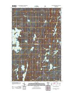
~ Angleworm Lake MN topo map, 1:24000 scale, 7.5 X 7.5 Minute, Historical, 2011
Angleworm Lake, Minnesota, USGS topographic map dated 2011.
Includes geographic coordinates (latitude and longitude). This topographic map is suitable for hiking, camping, and exploring, or framing it as a wall map.
Printed on-demand using high resolution imagery, on heavy weight and acid free paper, or alternatively on a variety of synthetic materials.
Topos available on paper, Waterproof, Poly, or Tyvek. Usually shipping rolled, unless combined with other folded maps in one order.
- Product Number: USGS-5465700
- Free digital map download (high-resolution, GeoPDF): Angleworm Lake, Minnesota (file size: 15 MB)
- Map Size: please refer to the dimensions of the GeoPDF map above
- Weight (paper map): ca. 55 grams
- Map Type: POD USGS Topographic Map
- Map Series: US Topo
- Map Verison: Historical
- Cell ID: 1041
- Datum: North American Datum of 1983
- Map Projection: Transverse Mercator
- Map Cell Name: Angleworm Lake
- Grid size: 7.5 X 7.5 Minute
- Date on map: 2011
- Map Scale: 1:24000
- Geographical region: Minnesota, United States
Neighboring Maps:
All neighboring USGS topo maps are available for sale online at a variety of scales.
Spatial coverage:
Topo map Angleworm Lake, Minnesota, covers the geographical area associated the following places:
- Big Lake - Little Bass Lake - Second Creek - Hopkins Lake - Agassa Lake - Regenbogen Lake - Keneu Lake - North Hegman Lake - Angleworm Lake - Hardtack Lake - Trease Lake - Stuart Portage - Hook Lake - First Lake - Unorganized Territory of Slim Lake (historical) - Swamp Creek - Slim Lake - Baldpate Creek - Ed Shave Lake - Nightingale Lake - Chorus Lake - Hunch Lake - Rice Lake - Baldpate Lake - Tee Lake - South Hegman Lake - Pictured Rocks - Angleworm Lookout Tower - Nels Lake
- Map Area ID: AREA48.12548-92-91.875
- Northwest corner Lat/Long code: USGSNW48.125-92
- Northeast corner Lat/Long code: USGSNE48.125-91.875
- Southwest corner Lat/Long code: USGSSW48-92
- Southeast corner Lat/Long code: USGSSE48-91.875
- Northern map edge Latitude: 48.125
- Southern map edge Latitude: 48
- Western map edge Longitude: -92
- Eastern map edge Longitude: -91.875


