
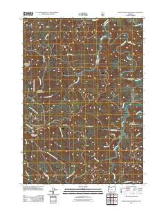
~ Roman Nose Mountain OR topo map, 1:24000 scale, 7.5 X 7.5 Minute, Historical, 2011
Roman Nose Mountain, Oregon, USGS topographic map dated 2011.
Includes geographic coordinates (latitude and longitude). This topographic map is suitable for hiking, camping, and exploring, or framing it as a wall map.
Printed on-demand using high resolution imagery, on heavy weight and acid free paper, or alternatively on a variety of synthetic materials.
Topos available on paper, Waterproof, Poly, or Tyvek. Usually shipping rolled, unless combined with other folded maps in one order.
- Product Number: USGS-5465270
- Free digital map download (high-resolution, GeoPDF): Roman Nose Mountain, Oregon (file size: 27 MB)
- Map Size: please refer to the dimensions of the GeoPDF map above
- Weight (paper map): ca. 55 grams
- Map Type: POD USGS Topographic Map
- Map Series: US Topo
- Map Verison: Historical
- Cell ID: 38484
- Datum: North American Datum of 1983
- Map Projection: Transverse Mercator
- Map Cell Name: Roman Nose Mountain
- Grid size: 7.5 X 7.5 Minute
- Date on map: 2011
- Map Scale: 1:24000
- Geographical region: Oregon, United States
Neighboring Maps:
All neighboring USGS topo maps are available for sale online at a variety of scales.
Spatial coverage:
Topo map Roman Nose Mountain, Oregon, covers the geographical area associated the following places:
- Roman Nose Mountain - Linslaw Park Boat Ramp - Luce Place (historical) - Twin Sisters Creek Camp (historical) - Whittaker Creek - Cedar Creek - Big Canyon Creek - Whittaker Creek Recreational Reservoir - Cabin Creek - Esmond Creek - Whittaker Creek Timber Pole Slide - Sutherland Creek - Esmond Creek Recreation Area - Whittaker Creek Recreation Site - Bounds Creek - Alma School (historical) - Cox Creek - Ford Access Boat Ramp - Leopold Creek - Kline Creek
- Map Area ID: AREA4443.875-123.75-123.625
- Northwest corner Lat/Long code: USGSNW44-123.75
- Northeast corner Lat/Long code: USGSNE44-123.625
- Southwest corner Lat/Long code: USGSSW43.875-123.75
- Southeast corner Lat/Long code: USGSSE43.875-123.625
- Northern map edge Latitude: 44
- Southern map edge Latitude: 43.875
- Western map edge Longitude: -123.75
- Eastern map edge Longitude: -123.625


