
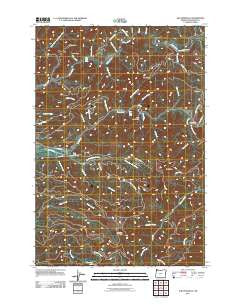
~ The Peninsula OR topo map, 1:24000 scale, 7.5 X 7.5 Minute, Historical, 2011
The Peninsula, Oregon, USGS topographic map dated 2011.
Includes geographic coordinates (latitude and longitude). This topographic map is suitable for hiking, camping, and exploring, or framing it as a wall map.
Printed on-demand using high resolution imagery, on heavy weight and acid free paper, or alternatively on a variety of synthetic materials.
Topos available on paper, Waterproof, Poly, or Tyvek. Usually shipping rolled, unless combined with other folded maps in one order.
- Product Number: USGS-5464427
- Free digital map download (high-resolution, GeoPDF): The Peninsula, Oregon (file size: 28 MB)
- Map Size: please refer to the dimensions of the GeoPDF map above
- Weight (paper map): ca. 55 grams
- Map Type: POD USGS Topographic Map
- Map Series: US Topo
- Map Verison: Historical
- Cell ID: 44769
- Datum: North American Datum of 1983
- Map Projection: Transverse Mercator
- Map Cell Name: The Peninsula
- Grid size: 7.5 X 7.5 Minute
- Date on map: 2011
- Map Scale: 1:24000
- Geographical region: Oregon, United States
Neighboring Maps:
All neighboring USGS topo maps are available for sale online at a variety of scales.
Spatial coverage:
Topo map The Peninsula, Oregon, covers the geographical area associated the following places:
- The Dam Hole - Fish Corner - Ginger Peak - Deswort Dairy - Blue Ridge Creek - Mills Bridge - Hanenkrat Creek - The Peninsula - Ming Creek - Stones Gap - Little North Fork Wilson River - Little Rock Creek - Blue Ridge - Negro Jack Creek - Samson Creek - Rawe Creek - Trask River State Fish Hatchery - Ming Point - Stones Road Boat Launch - Hatchery Creek - Kansas Creek - Charles Sprague Memorial Wayside - Upper Peninsula Pole Slide Boat Ramp - Panther Creek - Sylvan Creek - Edwards Butte - The Blue Hole - Mills Bridge County Drift Boat Launch - Gold Creek - Stone Camp Pole Slide Boat Launch - Smith Creek - Gold Peak - Cedar Creek - Burton Creek - Siskeyville (historical) - Siskeyville County Pole Slide Drift Boat Launch - Sheridan Creek - Zig Zag Creek - North Fork Gold Creek - Slide Creek - Demoley Wilson County Park - Lorens Drift Boat Launch - Tillison Creek - Mining Creek - Trowbridge Creek - Chance Creek - Bill Creek - Deadman Creek - Cedar Creek - Lower Peninsula / Last Chance - Fern Creek - Peninsula Day-Use Area - Tillamook Division
- Map Area ID: AREA45.545.375-123.75-123.625
- Northwest corner Lat/Long code: USGSNW45.5-123.75
- Northeast corner Lat/Long code: USGSNE45.5-123.625
- Southwest corner Lat/Long code: USGSSW45.375-123.75
- Southeast corner Lat/Long code: USGSSE45.375-123.625
- Northern map edge Latitude: 45.5
- Southern map edge Latitude: 45.375
- Western map edge Longitude: -123.75
- Eastern map edge Longitude: -123.625


