
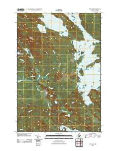
~ West Lake ME topo map, 1:24000 scale, 7.5 X 7.5 Minute, Historical, 2011
West Lake, Maine, USGS topographic map dated 2011.
Includes geographic coordinates (latitude and longitude). This topographic map is suitable for hiking, camping, and exploring, or framing it as a wall map.
Printed on-demand using high resolution imagery, on heavy weight and acid free paper, or alternatively on a variety of synthetic materials.
Topos available on paper, Waterproof, Poly, or Tyvek. Usually shipping rolled, unless combined with other folded maps in one order.
- Product Number: USGS-5464187
- Free digital map download (high-resolution, GeoPDF): West Lake, Maine (file size: 26 MB)
- Map Size: please refer to the dimensions of the GeoPDF map above
- Weight (paper map): ca. 55 grams
- Map Type: POD USGS Topographic Map
- Map Series: US Topo
- Map Verison: Historical
- Cell ID: 76680
- Datum: North American Datum of 1983
- Map Projection: Transverse Mercator
- Map Cell Name: West Lake
- Grid size: 7.5 X 7.5 Minute
- Date on map: 2011
- Map Scale: 1:24000
- Geographical region: Maine, United States
Neighboring Maps:
All neighboring USGS topo maps are available for sale online at a variety of scales.
Spatial coverage:
Topo map West Lake, Maine, covers the geographical area associated the following places:
- Nicatous Club - Nicatous Lake - Otter Pond - Bacon Island - T40 MD BPP - West Lake Ridge - Eagle Lake Trail - Oxhead Stream - Eagle Brook - Middle Oxhead Pond - Lower Oxhead Pond - Perch Island - Morrison Ridge - Dayton Island - Loon Pond - Little Guagus Stream - Trout Pond - Coombs Brook - Abamgamook Lake - Partridge Brook - Butterfield Island - Moose Cove - Sand Island - Dollar Island - Eagle Lake - Mace Brook - Crystal Pond - Cranberry Island - West Lake - Little Pickerel Pond
- Map Area ID: AREA45.12545-68.25-68.125
- Northwest corner Lat/Long code: USGSNW45.125-68.25
- Northeast corner Lat/Long code: USGSNE45.125-68.125
- Southwest corner Lat/Long code: USGSSW45-68.25
- Southeast corner Lat/Long code: USGSSE45-68.125
- Northern map edge Latitude: 45.125
- Southern map edge Latitude: 45
- Western map edge Longitude: -68.25
- Eastern map edge Longitude: -68.125


