
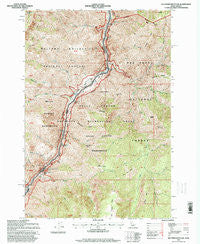
~ Old Timer Mountain ID topo map, 1:24000 scale, 7.5 X 7.5 Minute, Historical, 1995, updated 1999
Old Timer Mountain, Idaho, USGS topographic map dated 1995.
Includes geographic coordinates (latitude and longitude). This topographic map is suitable for hiking, camping, and exploring, or framing it as a wall map.
Printed on-demand using high resolution imagery, on heavy weight and acid free paper, or alternatively on a variety of synthetic materials.
Topos available on paper, Waterproof, Poly, or Tyvek. Usually shipping rolled, unless combined with other folded maps in one order.
- Product Number: USGS-5443830
- Free digital map download (high-resolution, GeoPDF): Old Timer Mountain, Idaho (file size: 21 MB)
- Map Size: please refer to the dimensions of the GeoPDF map above
- Weight (paper map): ca. 55 grams
- Map Type: POD USGS Topographic Map
- Map Series: HTMC
- Map Verison: Historical
- Cell ID: 33112
- Scan ID: 237462
- Imprint Year: 1999
- Woodland Tint: Yes
- Aerial Photo Year: 1992
- Field Check Year: 1995
- Datum: NAD27
- Map Projection: Transverse Mercator
- Map published by United States Geological Survey
- Map Language: English
- Scanner Resolution: 600 dpi
- Map Cell Name: Old Timer Mountain
- Grid size: 7.5 X 7.5 Minute
- Date on map: 1995
- Map Scale: 1:24000
- Geographical region: Idaho, United States
Neighboring Maps:
All neighboring USGS topo maps are available for sale online at a variety of scales.
Spatial coverage:
Topo map Old Timer Mountain, Idaho, covers the geographical area associated the following places:
- Bear Trap Creek - McLead Ranch - Lightning Creek - Goat Ridge - Indian Trail Ridge - Sheep Creek - Waterspout Rapids - Log Creek - Eagle Nest Rapids - Middle Fork Clarks Fork - McGaffee Cabin - Sheep Creek Point - Stickney Garden - Bills Creek Rapids - Low Saddle - Pony Creek - Sluice Creek - Smooth Hollow - Goat Rock Creek - Rush Creek Rapids - Upper Bernard Creek Rapids - Hells Canyon Wilderness - Willow Creek Rapids - McCatron Ridge - Sand Creek - Willow Creek - Pony Bar - Sheep Creek Rapids - Bills Creek - Cub Creek - Clarks Ridge - Old Timer Mountain - Wilson Cabin - Wilson Cabin - Stickney Basin - Bernard Creek - Clarks Fork - Middle Ridge - Wilson Cow Camp - Pine Bar - Yreka Creek - Lower Bernard Creek Rapids - East Fork Sheep Creek - Waterspout Creek - Clarks Hole - Johnson Bar - Sluice Creek Rapids - Cougar Basin - West Fork Sheep Creek - Buck Park - No-Name Rapids - Dry Basin - Sawyer Creek - Steep Creek - Old Timer Creek - Marks Creek - Weinheimer Gulch - Saddle Creek - Stormy Point - North Fork Lightning Creek - Saddle Gulch - McGaffee Basin - Hat Creek - Rush Creek - Rattlesnake Creek - Wilson
- Map Area ID: AREA45.545.375-116.625-116.5
- Northwest corner Lat/Long code: USGSNW45.5-116.625
- Northeast corner Lat/Long code: USGSNE45.5-116.5
- Southwest corner Lat/Long code: USGSSW45.375-116.625
- Southeast corner Lat/Long code: USGSSE45.375-116.5
- Northern map edge Latitude: 45.5
- Southern map edge Latitude: 45.375
- Western map edge Longitude: -116.625
- Eastern map edge Longitude: -116.5


