
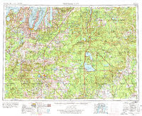
~ Traverse City MI topo map, 1:250000 scale, 1 X 2 Degree, Historical, 1954, updated 1978
Traverse City, Michigan, USGS topographic map dated 1954.
Includes geographic coordinates (latitude and longitude). This topographic map is suitable for hiking, camping, and exploring, or framing it as a wall map.
Printed on-demand using high resolution imagery, on heavy weight and acid free paper, or alternatively on a variety of synthetic materials.
Topos available on paper, Waterproof, Poly, or Tyvek. Usually shipping rolled, unless combined with other folded maps in one order.
- Product Number: USGS-5443784
- Free digital map download (high-resolution, GeoPDF): Traverse City, Michigan (file size: 23 MB)
- Map Size: please refer to the dimensions of the GeoPDF map above
- Weight (paper map): ca. 55 grams
- Map Type: POD USGS Topographic Map
- Map Series: HTMC
- Map Verison: Historical
- Cell ID: 69058
- Scan ID: 278770
- Imprint Year: 1978
- Woodland Tint: Yes
- Aerial Photo Year: 1953
- Edit Year: 1964
- Datum: Unstated
- Map Projection: Transverse Mercator
- Map published by United States Army Corps of Engineers
- Map published by United States Army
- Map Language: English
- Scanner Resolution: 600 dpi
- Map Cell Name: Traverse City
- Grid size: 1 X 2 Degree
- Date on map: 1954
- Map Scale: 1:250000
- Geographical region: Michigan, United States
Neighboring Maps:
All neighboring USGS topo maps are available for sale online at a variety of scales.
Spatial coverage:
Topo map Traverse City, Michigan, covers the geographical area associated the following places:
- Vogel Center - Bellaire - Meredith - Babbits Resort - Cadillac Leisure Mobile Home Community - Fountain Point - Eldorado - Tustin - Highland - Fife Lake - Haring - Hatchs - Biggs Settlement - Giddings - Camp Lu Lay Lea - Yuma - Higgins Lake Hideaway Mobile Home Park - Marilla - Tent City - Skidway Lake - Cooperton - Cedar - Meauwataka - Wagarville - Jennings - Birchwood Beach - Rainbow Bend - Pisgah Heights - Houseman - Crystal Spring - Ina - Alger - Danish Landing - Bodus - Solon - Pheasant Ridge Estates Mobile Home Park - Karlin - Pine Court Mobile Home Park - Bagnall - Elk Rapids - Pearll City - Glengary - West Branch - Wellston - Fayettes Corner - Spencer - Kingsley - King's Court Mobile Home Park - Bendon - Collens Landing - Hillcrest - Prudenville - Sterling - Angel - Piney Woods - Fivemile Corner - Bates - Irons - Peacock - Pioneer - Buck Trails - Taffeltown - Isadore - Cherryland Mobile Home Park - Devils Elbow - McIntyre Landing - Shady Lane Trailer Court - Hilltop - Nessen City - Harrison Mobile Home Estates - Moorestown - Grayling - Rapid City - Skeels - Cedar Run - Mio - Wildwood - Pavlovic Corner - Barker Creek - Acme - Arlene - Walton - Frederic - Edgetts - Lake City - Old Mission - Garland Village - Platte River - Harlan - Meadow Lane Mobile Home Park - Skyline Village - Lupton - Le Roy - Keno - Lake Margrethe - Keelans Corner - Wexford Corner - Kewadin - Baxter - Sugar Rapids
- Map Area ID: AREA4544-86-84
- Northwest corner Lat/Long code: USGSNW45-86
- Northeast corner Lat/Long code: USGSNE45-84
- Southwest corner Lat/Long code: USGSSW44-86
- Southeast corner Lat/Long code: USGSSE44-84
- Northern map edge Latitude: 45
- Southern map edge Latitude: 44
- Western map edge Longitude: -86
- Eastern map edge Longitude: -84


