
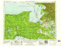
~ Sault Sainte Marie MI topo map, 1:250000 scale, 1 X 2 Degree, Historical, 1958
Sault Sainte Marie, Michigan, USGS topographic map dated 1958.
Includes geographic coordinates (latitude and longitude). This topographic map is suitable for hiking, camping, and exploring, or framing it as a wall map.
Printed on-demand using high resolution imagery, on heavy weight and acid free paper, or alternatively on a variety of synthetic materials.
Topos available on paper, Waterproof, Poly, or Tyvek. Usually shipping rolled, unless combined with other folded maps in one order.
- Product Number: USGS-5443764
- Free digital map download (high-resolution, GeoPDF): Sault Sainte Marie, Michigan (file size: 19 MB)
- Map Size: please refer to the dimensions of the GeoPDF map above
- Weight (paper map): ca. 55 grams
- Map Type: POD USGS Topographic Map
- Map Series: HTMC
- Map Verison: Historical
- Cell ID: 69018
- Scan ID: 278759
- Woodland Tint: Yes
- Field Check Year: 1954
- Datum: Unstated
- Map Projection: Transverse Mercator
- Map published by United States Geological Survey
- Map Language: English
- Scanner Resolution: 600 dpi
- Map Cell Name: Sault Sainte Marie
- Grid size: 1 X 2 Degree
- Date on map: 1958
- Map Scale: 1:250000
- Geographical region: Michigan, United States
Neighboring Maps:
All neighboring USGS topo maps are available for sale online at a variety of scales.
Spatial coverage:
Topo map Sault Sainte Marie, Michigan, covers the geographical area associated the following places:
- Raco - Laketon - Mission - Danaher - Timberlost - Engadine - Carpenter Landing - Brevort - Charles - Trout Lake - Parkington - Churchville - Blaney Park - Munuscong - Rudyard - McPhees Landing - Riverside Mobile Home Village - Blaney Junction - Chippewa Travel Trailer Park - Kelden - Bay Mills - Oak Ridge - Great Northern Trailer Court - Pontchartrain Shores - Cordell - McLeods Corner - Newberry - Helmer - Gardenville - Payment - Snug Harbor - Eckerman - L and M Trailer Park - Homestead - Rosedale - Kenneth - Westons Iroquois Beach - Corinne - Curtis - Dick - Brimley - Hessel - Epoufette - Rockview - Lencel - Stalwart - Strongs Corner - Lake Superior Estates - Pine Stump Junction - McMillan Corner - Shelldrake - Stirlingville - Lavender Corner - Donaldson - Whitehouse Landing - Dollarville - Garnet - Rexton - Seney - Ozark - Raber - Betty B Landing - Seewhy - Shallows - Eckerman Corner - Fornicola Trailer Park - McCarron - Strongs - Whitefish Point - Fourmile Corner - Sault Sainte Marie - Germfask - Inland - Dorgans Crossing - Grand Marais - Emerson - Barbeau - Goetzville - Caffey Corner - Hulbert - Kinross - Natalie - Naubinway - Dryburg - Deer Park - Vermilion - Dafter - Huntspur - Paradise - Gould City - Soo Junction - Fibre - Baie de Wasai - Pickford - Caffey - Brassar - Dollar Settlement - Eightmile Corner - Gilchrist - McMillan
- Map Area ID: AREA4746-86-84
- Northwest corner Lat/Long code: USGSNW47-86
- Northeast corner Lat/Long code: USGSNE47-84
- Southwest corner Lat/Long code: USGSSW46-86
- Southeast corner Lat/Long code: USGSSE46-84
- Northern map edge Latitude: 47
- Southern map edge Latitude: 46
- Western map edge Longitude: -86
- Eastern map edge Longitude: -84


