
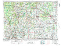
~ Midland MI topo map, 1:250000 scale, 1 X 2 Degree, Historical, 1954, updated 1984
Midland, Michigan, USGS topographic map dated 1954.
Includes geographic coordinates (latitude and longitude). This topographic map is suitable for hiking, camping, and exploring, or framing it as a wall map.
Printed on-demand using high resolution imagery, on heavy weight and acid free paper, or alternatively on a variety of synthetic materials.
Topos available on paper, Waterproof, Poly, or Tyvek. Usually shipping rolled, unless combined with other folded maps in one order.
- Product Number: USGS-5443760
- Free digital map download (high-resolution, GeoPDF): Midland, Michigan (file size: 23 MB)
- Map Size: please refer to the dimensions of the GeoPDF map above
- Weight (paper map): ca. 55 grams
- Map Type: POD USGS Topographic Map
- Map Series: HTMC
- Map Verison: Historical
- Cell ID: 68909
- Scan ID: 278757
- Imprint Year: 1984
- Woodland Tint: Yes
- Aerial Photo Year: 1953
- Edit Year: 1971
- Datum: Unstated
- Map Projection: Transverse Mercator
- Map published by: Military, Other
- Map Language: English
- Scanner Resolution: 600 dpi
- Map Cell Name: Midland
- Grid size: 1 X 2 Degree
- Date on map: 1954
- Map Scale: 1:250000
- Geographical region: Michigan, United States
Neighboring Maps:
All neighboring USGS topo maps are available for sale online at a variety of scales.
Spatial coverage:
Topo map Midland, Michigan, covers the geographical area associated the following places:
- Lake George - Dice - Ravenna - Lamont - Maple Rapids - Six Lakes - Maple Grove Mobile Home Village - Maple View Estates Mobile Home Park - Woodcrest Estates Mobile Home Park - Ola - Nesen's Countryside Mobile Home Park - Bentley - Eastmanville - Chase - Coleman - Bridgeville - Stanton Mobile Home Park - Leaton - Vernon City - Freeland - Rustford - Saint Johns - White Birch Village Mobile Home Park - Ashton - Stanton - Marion Springs - Cedar Springs - Titus - Mount Pleasant - Pleasant Valley - McLean - Mount Pleasant Mobile Home Village - Pompeii - Dayton Center - Laporte - Curtis - Iva - Lakeview Village Mobile Home Park - Crossings on Broadway Mobile Home Park - Pierson - White Birch Estates Mobile Home Park - Parshallburg - Oxbow - Amble - Isabella Mobile Home Park - Stoddard Mobile Court - Orono - Edgewood Village Mobile Home Park - Seidlers - Moorland - Hemlock - Edgerton - Pleasant Beach Mobile Home Park - Fruit Ridge Center - Belding - Drew - Saint Johns Mobile Home Village - Hope - Hilltop Mobile Home Park - Horr - Sylvester - Redstone - Orleans - Alpine - Northview - Smyrna - Pewamo - Roosevelt - Harrisburg - Marlborough - Hunters Creek Estates Mobile Home Park - Country Village Mobile Park - Crawford - Coral - Northern Estates Mobile Home Village North - Fremont - Winegars - Green Acres Mobile Home Park - Herrington - Slocum - Ashland Center - North Wheeler - Youngs Trailer Park - Casnovia - Gladwin - Halls Corner - Country Side Mobile Home Park - Dice Corners - Beaver - Lake - Sand Lake - Lakeside Mobile Home Community - McBride - Oakley - Reno - Alpine Mobile Home Village - Wheeler - Crystal - Northwood Estates Mobile Home Park - Evans
- Map Area ID: AREA4443-86-84
- Northwest corner Lat/Long code: USGSNW44-86
- Northeast corner Lat/Long code: USGSNE44-84
- Southwest corner Lat/Long code: USGSSW43-86
- Southeast corner Lat/Long code: USGSSE43-84
- Northern map edge Latitude: 44
- Southern map edge Latitude: 43
- Western map edge Longitude: -86
- Eastern map edge Longitude: -84


