
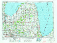
~ Flint MI topo map, 1:250000 scale, 1 X 2 Degree, Historical, 1954, updated 1973
Flint, Michigan, USGS topographic map dated 1954.
Includes geographic coordinates (latitude and longitude). This topographic map is suitable for hiking, camping, and exploring, or framing it as a wall map.
Printed on-demand using high resolution imagery, on heavy weight and acid free paper, or alternatively on a variety of synthetic materials.
Topos available on paper, Waterproof, Poly, or Tyvek. Usually shipping rolled, unless combined with other folded maps in one order.
- Product Number: USGS-5443726
- Free digital map download (high-resolution, GeoPDF): Flint, Michigan (file size: 20 MB)
- Map Size: please refer to the dimensions of the GeoPDF map above
- Weight (paper map): ca. 55 grams
- Map Type: POD USGS Topographic Map
- Map Series: HTMC
- Map Verison: Historical
- Cell ID: 68779
- Scan ID: 278734
- Imprint Year: 1973
- Woodland Tint: Yes
- Aerial Photo Year: 1970
- Edit Year: 1971
- Field Check Year: 1954
- Datum: Unstated
- Map Projection: Transverse Mercator
- Map published by United States Geological Survey
- Map Language: English
- Scanner Resolution: 600 dpi
- Map Cell Name: Flint
- Grid size: 1 X 2 Degree
- Date on map: 1954
- Map Scale: 1:250000
- Geographical region: Michigan, United States
Neighboring Maps:
All neighboring USGS topo maps are available for sale online at a variety of scales.
Spatial coverage:
Topo map Flint, Michigan, covers the geographical area associated the following places:
- Capac - Saginaw Bay Estates Mobile Home Park - Tobico Beach - Riverside Mobile Home Park - Tradewind Mobile Court - Frankentrost - Denmark Junction - Carsonville - Harbor Beach - Donahue Beach - Avoca - Caro - North Dort Manor Mobile Home Park - Kearsley Lake Terrace Mobile Home Park - Holt's Mobile Home Court - Westwood Village Mobile Home Park - White Oak Estates Mobile Home Park - West Bay City - Valley Island - Montrose - Arn - Watrousville - Imlay City - Cash - Carriage Manor Mobile Home Park - North Branch Meadows Mobile Home Park - Filion - Forester - North Branch - Country Hill Pines Mobile Home Park - Bayside Estates Mobile Home Park - Millington - Ruth - North Morris Estates Mobile Home Park - Kilmanagh - Deford - Attica - Colwood - Riverview Mobile Home Estates - Bad Axe - Davison East Mobile Estates - Verona - Popple - Daytona Branch - Gera - Flushing - Robin Glen Mobile Home Community - Ivanhoe - Brockway - Peatville - Decker - Speaker - Standish - Mount Morris - Unionville - Redman - Kochville - White Rock - Kirkwood Community Mobile Home Park - Birch Run - Mayville - Winter's Motor Court - Melvin - Lapeer - Juhl - Pasadena Mobile Home Park - Austin Center - Thomas - Birch Beach - Akron - Layton Corners - Sandpiper Estates Cooperative Mobile Home Park - Country Meadow Mobile Home Park - Lakeport - New Greenleaf - Shady Acres Mobile Home Park - Pine Forest Mobile Home Park - Blaine - Brentwood Estates Mobile Home Park - Kinde - Zilwaukee - Port Sanilac - Bay Port - Freidberger - Frankenmuth - Woodvalley Mobile Home Park - New Lothrop - Gagetown - Pheasant Run Mobile Home Park - Bay Village Mobile Home Estates - Laing - Holiday Village Mobile Home Park - Atkins - Berne - Ellington - Bay Park - Blue Water Beach - Bach - Saginaw - Heather Hill Estates Mobile Home Park
- Map Area ID: AREA4443-84-82
- Northwest corner Lat/Long code: USGSNW44-84
- Northeast corner Lat/Long code: USGSNE44-82
- Southwest corner Lat/Long code: USGSSW43-84
- Southeast corner Lat/Long code: USGSSE43-82
- Northern map edge Latitude: 44
- Southern map edge Latitude: 43
- Western map edge Longitude: -84
- Eastern map edge Longitude: -82


