
~ Flint MI topo map, 1:250000 scale, 1 X 2 Degree, Historical, 1954, updated 1974
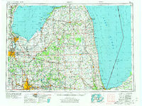
Flint, Michigan, USGS topographic map dated 1954.
Includes geographic coordinates (latitude and longitude). This topographic map is suitable for hiking, camping, and exploring, or framing it as a wall map.
Printed on-demand using high resolution imagery, on heavy weight and acid free paper, or alternatively on a variety of synthetic materials.
Topos available on paper, Waterproof, Poly, or Tyvek. Usually shipping rolled, unless combined with other folded maps in one order.
- Product Number: USGS-5443724
- Free digital map download (high-resolution, GeoPDF): Flint, Michigan (file size: 22 MB)
- Map Size: please refer to the dimensions of the GeoPDF map above
- Weight (paper map): ca. 55 grams
- Map Type: POD USGS Topographic Map
- Map Series: HTMC
- Map Verison: Historical
- Cell ID: 68779
- Scan ID: 278733
- Imprint Year: 1974
- Woodland Tint: Yes
- Aerial Photo Year: 1970
- Edit Year: 1971
- Field Check Year: 1954
- Datum: Unstated
- Map Projection: Transverse Mercator
- Map published by United States Geological Survey
- Map Language: English
- Scanner Resolution: 600 dpi
- Map Cell Name: Flint
- Grid size: 1 X 2 Degree
- Date on map: 1954
- Map Scale: 1:250000
- Geographical region: Michigan, United States
Neighboring Maps:
All neighboring USGS topo maps are available for sale online at a variety of scales.
Spatial coverage:
Topo map Flint, Michigan, covers the geographical area associated the following places:
- Burnside - Sebewaing - Mayville - Sugartree Mobile Home Park - Kearsley Lake Terrace Mobile Home Park - Meyers Beach - Bay Village Mobile Home Estates - Vassar - Lapeer Heights - Thetford Center - Woodvalley Mobile Home Park - Elkton - Bay Port - Valley Mobile Home Park - Bayside Estates Mobile Home Park - Alpine Village Mobile Home Park - Deford - Buena Vista - Peachtree Manor Mobile Home Park - Otter Lake - Montrose Mobile Home Park - Dayton - Ruby - Blue Water Beach - Keewahdin - Buell Hill Estates Mobile Home Park - Kilmanagh - McGrew Junction - Riverview Mobile Home Estates - Cass City - Birch Beach - Robin Glen Mobile Home Community - Capac - Riverview Mobile Home Park - Jeddo - North Branch - Pigeon - Avoca - Pheasant Run Mobile Home Park - Denmark Junction - Argyle - Croswell - Linkville - Highlands Mobile Home Park - Atkins - Lum - Attica - Country Meadow Mobile Home Park - Peck - Pinconning - Applegate - Arn - Indiantown - Gardendale - Kingston - North Hill Mobile Home Village - Belsay - Chateau Timber Heights Mobile Home Park - Filion - Kirkwood Community Mobile Home Park - Blaine - Lapeer - Abbottsford - Amadore - Merrillsville (historical) - McGregor - Forestville - East Dayton - Snover - Aplin Beach - Bay City - Gunther Mobile Home Court - South Creek Village Mobile Home Park - Shady Acres Mobile Home Park - Saganing - Cash - Port Sanilac - Bad Axe - Reese - North Morris Estates Mobile Home Park - Rapson - Saginaw - Flushing - Wickware - Gera - Bay Side Village Mobile Home Park - Meadows Mobile Home Park - Rose Island - Birch Run - Great Lakes Beach - Carriage Hills Mobile Home Park - Linwood Beach - Marlette - Munger - Gagetown - Elmer - Lagoon Beach - Ubly - Redman - Killarney Beach
- Map Area ID: AREA4443-84-82
- Northwest corner Lat/Long code: USGSNW44-84
- Northeast corner Lat/Long code: USGSNE44-82
- Southwest corner Lat/Long code: USGSSW43-84
- Southeast corner Lat/Long code: USGSSE43-82
- Northern map edge Latitude: 44
- Southern map edge Latitude: 43
- Western map edge Longitude: -84
- Eastern map edge Longitude: -82


