
~ Flint MI topo map, 1:250000 scale, 1 X 2 Degree, Historical, 1954, updated 1968
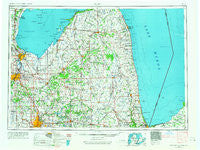
Flint, Michigan, USGS topographic map dated 1954.
Includes geographic coordinates (latitude and longitude). This topographic map is suitable for hiking, camping, and exploring, or framing it as a wall map.
Printed on-demand using high resolution imagery, on heavy weight and acid free paper, or alternatively on a variety of synthetic materials.
Topos available on paper, Waterproof, Poly, or Tyvek. Usually shipping rolled, unless combined with other folded maps in one order.
- Product Number: USGS-5443722
- Free digital map download (high-resolution, GeoPDF): Flint, Michigan (file size: 15 MB)
- Map Size: please refer to the dimensions of the GeoPDF map above
- Weight (paper map): ca. 55 grams
- Map Type: POD USGS Topographic Map
- Map Series: HTMC
- Map Verison: Historical
- Cell ID: 68779
- Scan ID: 278732
- Imprint Year: 1968
- Woodland Tint: Yes
- Edit Year: 1967
- Field Check Year: 1954
- Datum: Unstated
- Map Projection: Transverse Mercator
- Map published by United States Geological Survey
- Map Language: English
- Scanner Resolution: 600 dpi
- Map Cell Name: Flint
- Grid size: 1 X 2 Degree
- Date on map: 1954
- Map Scale: 1:250000
- Geographical region: Michigan, United States
Neighboring Maps:
All neighboring USGS topo maps are available for sale online at a variety of scales.
Spatial coverage:
Topo map Flint, Michigan, covers the geographical area associated the following places:
- Attica - Villageside Mobile Home Park - Sugartree Mobile Home Park - Elmwood - Caseville - Quanicassee - Five Lakes - Elmer - South Creek Village Mobile Home Park - North Dort Manor Mobile Home Park - Helena - Juniata - Cumber - Carsonville - Kearsley Lake Terrace Mobile Home Park - Fostoria - Vaughn Village Mobile Home Park - Gardendale - Meyers Beach - Thetford Center - Montrose Mobile Home Park - Kilmanagh - Bay Village Mobile Home Estates - Palms - Roseburg - Richfield Mobile Home Park - Freidberger - Watertown - Valley Mobile Home Park - Russellville - Myrtle Grove Mobile Home Park - Croswell - Colwood - Rose Island - Burnt - Hunters Creek Mobile Home Community - Taymouth - Glencoe - Aplin Beach - Birchwood Farms Mobile Home Park - Otisville - Flushing Estates Mobile Home Park - Bel-Air Mobile Home Park - East Dayton - Rogersville - Farrandville - Pheasant Run Mobile Home Park - Brockway - Vassar - Sandusky - Amadore - Richfield Center - Saginaw Bay Estates Mobile Home Park - Jeddo - Watertower Travel Trailer Park - Woodvalley Mobile Home Park - Pigeon - Gagetown - Pinnebog - Huron Shores Estates Mobile Home Park - Ruth - Heather Hill Estates Mobile Home Park - Riverview Mobile Home Estates - West Bay City - White Rock - Davison East Mobile Estates - Sandhill Mobile Home Estates - Little Killarney Beach - Chateau Old Orchard Mobile Home Park - Caro - Dayton - Misty Meadows Mobile Home Park - Bay Side Village Mobile Home Park - Riverview Mobile Home Park - Arn - Lakeside Mobile Court - Westwood Village Mobile Home Park - Whites Beach - Brent Creek - Birch Beach - Forester - Kochville - West Shore Estates Mobile Home Park - Windmill Estates Mobile Home Park - McGrew Junction - Berne - Akron - Flint - Lexington Heights - Lum - Ruby - Buell Hill Estates Mobile Home Park - Rapson - Highlands Mobile Home Park - Gera - Frankenmuth - Kinde - Bad Axe - Oakhurst - Lyndon Mobile Home Court
- Map Area ID: AREA4443-84-82
- Northwest corner Lat/Long code: USGSNW44-84
- Northeast corner Lat/Long code: USGSNE44-82
- Southwest corner Lat/Long code: USGSSW43-84
- Southeast corner Lat/Long code: USGSSE43-82
- Northern map edge Latitude: 44
- Southern map edge Latitude: 43
- Western map edge Longitude: -84
- Eastern map edge Longitude: -82


