
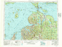
~ Cheboygan MI topo map, 1:250000 scale, 1 X 2 Degree, Historical, 1955, updated 1987
Cheboygan, Michigan, USGS topographic map dated 1955.
Includes geographic coordinates (latitude and longitude). This topographic map is suitable for hiking, camping, and exploring, or framing it as a wall map.
Printed on-demand using high resolution imagery, on heavy weight and acid free paper, or alternatively on a variety of synthetic materials.
Topos available on paper, Waterproof, Poly, or Tyvek. Usually shipping rolled, unless combined with other folded maps in one order.
- Product Number: USGS-5443702
- Free digital map download (high-resolution, GeoPDF): Cheboygan, Michigan (file size: 25 MB)
- Map Size: please refer to the dimensions of the GeoPDF map above
- Weight (paper map): ca. 55 grams
- Map Type: POD USGS Topographic Map
- Map Series: HTMC
- Map Verison: Historical
- Cell ID: 68713
- Scan ID: 278723
- Imprint Year: 1987
- Woodland Tint: Yes
- Aerial Photo Year: 1979
- Edit Year: 1981
- Field Check Year: 1955
- Datum: NAD27
- Map Projection: Transverse Mercator
- Map published by United States Geological Survey
- Map Language: English
- Scanner Resolution: 600 dpi
- Map Cell Name: Cheboygan
- Grid size: 1 X 2 Degree
- Date on map: 1955
- Map Scale: 1:250000
- Geographical region: Michigan, United States
Neighboring Maps:
All neighboring USGS topo maps are available for sale online at a variety of scales.
Spatial coverage:
Topo map Cheboygan, Michigan, covers the geographical area associated the following places:
- Stutsmanville - Edgewater Beach - Haakwood - Barnard - East Jordan Mobile Home Park - Lake Michigan Heights Mobile Home Park - Alverno - Martins Bluff - Black Lake - Torch Lake - Marsh Corner - Levering - Kingsley Beach - Ocqueoc - Freedom - Bay View - Grand View - British Landing - Creswell - Sparr - Nottingham Forest Mobile Home Park - Boulder Park - Boyne City - Grace - Atwood - Chalet Estates - Forest Beach - Grand View Beach - Conway - Petoskey - Silver Beach - Pleasant View - Bay Shore - Boyne Falls - Van - Patrick Landing - Onaway - Burt Lake - Middle Village - Zenith Heights - Ponshewaing - Ahgosatown - Birchwood - Eastport - Wauban Beach - Walloon Lake - Canada Creek Ranch - Weadock - Harbor Springs - Epsilon - Aloha - Green Timbers - Fort Mackinac - Allenville - Orchard Beach - Aspen Commons Mobile Home Park - Vanderbilt - Saint James - Fingerboard Corner - Cross Village - Chestonia - Hetherton - Mill Street Mobile Home Park - Carp Lake - Oden - Hangore Heights - Good Hart - Canfield Beach - Black Lake Bluffs - Haakwood (historical) - Lakeview Mobile Home Village - Huron Beach - Elmira - Afton - Ironton - Harbor Springs Estate - East Jordan - Giauque Beach - Hammond - Indian River - Burgess - Mackinac Island - Radio City Village Mobile Home Park - Saint Ignace - Pointe Aux Pins - Roaring Brook - Wequetonsing - Advance - Royal Oak Beach - Snowflake (historical) - North Manitou - Grand View - Chippewa Beach - Charlevoix - Brutus - High Banks - Legrand - Bell Landing - Cedarville - Bay Shore Estates
- Map Area ID: AREA4645-86-84
- Northwest corner Lat/Long code: USGSNW46-86
- Northeast corner Lat/Long code: USGSNE46-84
- Southwest corner Lat/Long code: USGSSW45-86
- Southeast corner Lat/Long code: USGSSE45-84
- Northern map edge Latitude: 46
- Southern map edge Latitude: 45
- Western map edge Longitude: -86
- Eastern map edge Longitude: -84


