
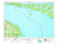
~ Alpena MI topo map, 1:250000 scale, 1 X 2 Degree, Historical, 1969
Alpena, Michigan, USGS topographic map dated 1969.
Includes geographic coordinates (latitude and longitude). This topographic map is suitable for hiking, camping, and exploring, or framing it as a wall map.
Printed on-demand using high resolution imagery, on heavy weight and acid free paper, or alternatively on a variety of synthetic materials.
Topos available on paper, Waterproof, Poly, or Tyvek. Usually shipping rolled, unless combined with other folded maps in one order.
- Product Number: USGS-5443686
- Free digital map download (high-resolution, GeoPDF): Alpena, Michigan (file size: 19 MB)
- Map Size: please refer to the dimensions of the GeoPDF map above
- Weight (paper map): ca. 55 grams
- Map Type: POD USGS Topographic Map
- Map Series: HTMC
- Map Verison: Historical
- Cell ID: 68643
- Scan ID: 278712
- Woodland Tint: Yes
- Field Check Year: 1954
- Datum: Unstated
- Map Projection: Transverse Mercator
- Map published by United States Geological Survey
- Map Language: English
- Scanner Resolution: 600 dpi
- Map Cell Name: Alpena
- Grid size: 1 X 2 Degree
- Date on map: 1969
- Map Scale: 1:250000
- Geographical region: Michigan, United States
Neighboring Maps:
All neighboring USGS topo maps are available for sale online at a variety of scales.
Spatial coverage:
Topo map Alpena, Michigan, covers the geographical area associated the following places:
- Big Cut - Long Rapids - Johnswood - Alpena Junction - Liske - Leroy - Presque Isle Estates - Ashland - Rockport - Lakeshore Estates Mobile Home Park - Bolton - Flanders - Lakewood - Alpena - Posen - Orchard - Presque Isle - Lincoln - Metz - Herron - McHarg - Cathro - Royston - Stoneport - Calcite - Spratt - Orchard Point - Moltke - Hillman - Harbor View - Hagensville - Paxton - Lachine - Bruningville - Polaski - Evergreen Beach - Belknap - Manitou Beach - De Tour Village - Emerson Station - Hawks - Leer - Sunrise Estates Mobile Home Community - Rogers City - Bell
- Map Area ID: AREA4645-84-82
- Northwest corner Lat/Long code: USGSNW46-84
- Northeast corner Lat/Long code: USGSNE46-82
- Southwest corner Lat/Long code: USGSSW45-84
- Southeast corner Lat/Long code: USGSSE45-82
- Northern map edge Latitude: 46
- Southern map edge Latitude: 45
- Western map edge Longitude: -84
- Eastern map edge Longitude: -82


