
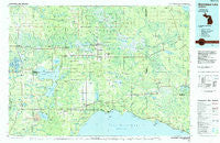
~ Manistique Lake MI topo map, 1:100000 scale, 30 X 60 Minute, Historical, 1985, updated 1985
Manistique Lake, Michigan, USGS topographic map dated 1985.
Includes geographic coordinates (latitude and longitude). This topographic map is suitable for hiking, camping, and exploring, or framing it as a wall map.
Printed on-demand using high resolution imagery, on heavy weight and acid free paper, or alternatively on a variety of synthetic materials.
Topos available on paper, Waterproof, Poly, or Tyvek. Usually shipping rolled, unless combined with other folded maps in one order.
- Product Number: USGS-5443632
- Free digital map download (high-resolution, GeoPDF): Manistique Lake, Michigan (file size: 28 MB)
- Map Size: please refer to the dimensions of the GeoPDF map above
- Weight (paper map): ca. 55 grams
- Map Type: POD USGS Topographic Map
- Map Series: HTMC
- Map Verison: Historical
- Cell ID: 67901
- Scan ID: 278684
- Imprint Year: 1985
- Woodland Tint: Yes
- Aerial Photo Year: 1983
- Edit Year: 1985
- Datum: NAD27
- Map Projection: Universal Transverse Mercator
- Planimetric: Yes
- Map published by United States Geological Survey
- Map Language: English
- Scanner Resolution: 600 dpi
- Map Cell Name: Manistique Lake
- Grid size: 30 X 60 Minute
- Date on map: 1985
- Map Scale: 1:100000
- Geographical region: Michigan, United States
Neighboring Maps:
All neighboring USGS topo maps are available for sale online at a variety of scales.
Spatial coverage:
Topo map Manistique Lake, Michigan, covers the geographical area associated the following places:
- Engadine - Soo Junction - Corinne - Natalie - Eckerman - Roberts Corner - Danaher - Huntspur - Fourmile Corner - McLeods Corner - Millecoquins - Naubinway - McPhees Landing - Parkington - Lencel - Gilchrist - Eckerman Corner - McMillan - Helmer - Seney - Laketon - Blaney Park - Gould City - Curtis - Betty B Landing - Dollarville - Marks - Great Northern Trailer Court - Caffey Corner - McMillan Corner - Eightmile Corner - Seewhy - Blaney Junction - Inland - Hulbert - Newberry - Germfask - Brevort - Epoufette - Caffey - Rexton - Carpenter Landing - Garnet - Trout Lake
- Map Area ID: AREA46.546-86-85
- Northwest corner Lat/Long code: USGSNW46.5-86
- Northeast corner Lat/Long code: USGSNE46.5-85
- Southwest corner Lat/Long code: USGSSW46-86
- Southeast corner Lat/Long code: USGSSE46-85
- Northern map edge Latitude: 46.5
- Southern map edge Latitude: 46
- Western map edge Longitude: -86
- Eastern map edge Longitude: -85


