
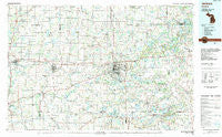
~ Jackson MI topo map, 1:100000 scale, 30 X 60 Minute, Historical, 1983, updated 1984
Jackson, Michigan, USGS topographic map dated 1983.
Includes geographic coordinates (latitude and longitude). This topographic map is suitable for hiking, camping, and exploring, or framing it as a wall map.
Printed on-demand using high resolution imagery, on heavy weight and acid free paper, or alternatively on a variety of synthetic materials.
Topos available on paper, Waterproof, Poly, or Tyvek. Usually shipping rolled, unless combined with other folded maps in one order.
- Product Number: USGS-5443612
- Free digital map download (high-resolution, GeoPDF): Jackson, Michigan (file size: 26 MB)
- Map Size: please refer to the dimensions of the GeoPDF map above
- Weight (paper map): ca. 55 grams
- Map Type: POD USGS Topographic Map
- Map Series: HTMC
- Map Verison: Historical
- Cell ID: 67721
- Scan ID: 278671
- Imprint Year: 1984
- Woodland Tint: Yes
- Aerial Photo Year: 1981
- Edit Year: 1983
- Datum: NAD27
- Map Projection: Universal Transverse Mercator
- Map published by United States Geological Survey
- Map Language: English
- Scanner Resolution: 600 dpi
- Map Cell Name: Jackson
- Grid size: 30 X 60 Minute
- Date on map: 1983
- Map Scale: 1:100000
- Geographical region: Michigan, United States
Neighboring Maps:
All neighboring USGS topo maps are available for sale online at a variety of scales.
Spatial coverage:
Topo map Jackson, Michigan, covers the geographical area associated the following places:
- Tipton - Manchester Manor Mobile Home Park - Litchfield - Munith - Country Manor Mobile Home Park - Sherman Oaks Mobile Park - Windham Hill Manufactured Home Community - Lanewood - Leslie Estates Mobile Home Park - Spring Arbor - Holiday Manor Park - Charlotte Landing - The Heights - Charlesworth - English Meadows Mobile Home Park - Tekonsha - Homer - North Leslie - Sylvan Center - Notten - Eckford - Clarence Center - Chalkerville - Berryville - Pulaski - Cozy Mobile Home Community - Grass Lake - Somerset - Napoleon - Brooklyn - Sprucetree Mobile Home Court - Cement City - Sandstone - Roots - Parma - Partello - Unadilla - Rowes Corner - Mosherville - Woodville - Rice Creek - Oak Point - Onsted - New Village Estates Mobile Home Park - Anderson - Wrights Corners - Hillanlake Village Mobile Home Park - Albion - Sharon Hollow - Ainger - Horton - Devils Lake - Lyndon Center - Gregory - Jerome - Jackson Mobile Home Park - Waterloo - Spring Valley Estates Mobile Home Park - Minards Mill - Fishville - Leslie - Devereaux - Clarklake - Liberty - Walnut Ridge Manufactured Home Community - Jefferson - Plainfield - Trist - Indian Village Mobile Home Park - Guthrie - Butler - Springville - Olivet - Manchester - Bentleys Corners - Kaiserville - Concord - Bunker Hill - Fitchburg - Silver Lawn Trailer Park - South Butler - Condit - Stoney Point - Hanover - Duck Lake - Bullis Crossing - Walnut Point - Stockbridge - Oak Shade Park - Springport - Williamsville - Pleasant Lake Mobile Home Court - Miller Trailer Village - Jackson - Babcock - Kinneville - Vinings Trailer Park - Brookfield - South Jackson - Lee Center
- Map Area ID: AREA42.542-85-84
- Northwest corner Lat/Long code: USGSNW42.5-85
- Northeast corner Lat/Long code: USGSNE42.5-84
- Southwest corner Lat/Long code: USGSSW42-85
- Southeast corner Lat/Long code: USGSSE42-84
- Northern map edge Latitude: 42.5
- Southern map edge Latitude: 42
- Western map edge Longitude: -85
- Eastern map edge Longitude: -84


