
~ Grayling MI topo map, 1:100000 scale, 30 X 60 Minute, Historical, 1983, updated 1984
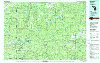
Grayling, Michigan, USGS topographic map dated 1983.
Includes geographic coordinates (latitude and longitude). This topographic map is suitable for hiking, camping, and exploring, or framing it as a wall map.
Printed on-demand using high resolution imagery, on heavy weight and acid free paper, or alternatively on a variety of synthetic materials.
Topos available on paper, Waterproof, Poly, or Tyvek. Usually shipping rolled, unless combined with other folded maps in one order.
- Product Number: USGS-5443586
- Free digital map download (high-resolution, GeoPDF): Grayling, Michigan (file size: 31 MB)
- Map Size: please refer to the dimensions of the GeoPDF map above
- Weight (paper map): ca. 55 grams
- Map Type: POD USGS Topographic Map
- Map Series: HTMC
- Map Verison: Historical
- Cell ID: 67603
- Scan ID: 278658
- Imprint Year: 1984
- Woodland Tint: Yes
- Visual Version Number: 1
- Aerial Photo Year: 1981
- Edit Year: 1983
- Datum: NAD27
- Map Projection: Universal Transverse Mercator
- Map published by United States Geological Survey
- Map Language: English
- Scanner Resolution: 600 dpi
- Map Cell Name: Grayling
- Grid size: 30 X 60 Minute
- Date on map: 1983
- Map Scale: 1:100000
- Geographical region: Michigan, United States
Neighboring Maps:
All neighboring USGS topo maps are available for sale online at a variety of scales.
Spatial coverage:
Topo map Grayling, Michigan, covers the geographical area associated the following places:
- Comins - Fletcher - Birchwood Beach - Garland Village - Collens Landing - Danish Landing - Vienna Corners - Otsego Lake - Fairview - Eldorado - Skyline Village - Eyedylwild Beach - Deerheart Valley - Alba - Pemberthy Crossing - McIntyre Landing - Tent City - Lower Chub Landing - Mio - Lewiston - Bucks - Vienna Junction - Deward - Log Haven Mobile Home Park - Farrar Landing - Pere Cheney - Kneeland - Rasmus - Arbutus Beach - Luzerne - Oak Grove - Babbits Resort - Johannesburg - Waters - Pearll City - Donnelly - Frederic - Louis Cabin Landing - Bigelow - Ishaward - Lovells - Forbush Corner - Biggs Settlement - Avery - Wildwood - Lake Margrethe - Grayling - Whites Landing - Five Corners - Red Oak
- Map Area ID: AREA4544.5-85-84
- Northwest corner Lat/Long code: USGSNW45-85
- Northeast corner Lat/Long code: USGSNE45-84
- Southwest corner Lat/Long code: USGSSW44.5-85
- Southeast corner Lat/Long code: USGSSE44.5-84
- Northern map edge Latitude: 45
- Southern map edge Latitude: 44.5
- Western map edge Longitude: -85
- Eastern map edge Longitude: -84


