
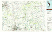
~ Flint MI topo map, 1:100000 scale, 30 X 60 Minute, Historical, 1984, updated 1985
Flint, Michigan, USGS topographic map dated 1984.
Includes geographic coordinates (latitude and longitude). This topographic map is suitable for hiking, camping, and exploring, or framing it as a wall map.
Printed on-demand using high resolution imagery, on heavy weight and acid free paper, or alternatively on a variety of synthetic materials.
Topos available on paper, Waterproof, Poly, or Tyvek. Usually shipping rolled, unless combined with other folded maps in one order.
- Product Number: USGS-5443578
- Free digital map download (high-resolution, GeoPDF): Flint, Michigan (file size: 22 MB)
- Map Size: please refer to the dimensions of the GeoPDF map above
- Weight (paper map): ca. 55 grams
- Map Type: POD USGS Topographic Map
- Map Series: HTMC
- Map Verison: Historical
- Cell ID: 67520
- Scan ID: 278654
- Imprint Year: 1985
- Woodland Tint: Yes
- Aerial Photo Year: 1982
- Edit Year: 1984
- Datum: NAD27
- Map Projection: Universal Transverse Mercator
- Planimetric: Yes
- Map published by United States Geological Survey
- Map Language: English
- Scanner Resolution: 600 dpi
- Map Cell Name: Flint
- Grid size: 30 X 60 Minute
- Date on map: 1984
- Map Scale: 1:100000
- Geographical region: Michigan, United States
Neighboring Maps:
All neighboring USGS topo maps are available for sale online at a variety of scales.
Spatial coverage:
Topo map Flint, Michigan, covers the geographical area associated the following places:
- Attica - Bel-Air Mobile Home Park - Riverview Mobile Home Park - Columbiaville - Pasadena Mobile Home Park - Beecher - Lapeer Meadows Mobile Home Park - Mayville - Cassbridge (historical) - Flint - Blumfield Corners - Caro Mobile Estates - Rogersville - Richfield Mobile Home Park - Twilight Mobile Home Park - Karrs Corner - Lum - McGrew Junction - North Morris Estates Mobile Home Park - Hemans - Meadowbrook Manor Estates Mobile Home Park - Hunters Creek Mobile Home Community - North Branch Meadows Mobile Home Park - Thetford Center - Shady Acres Mobile Home Park - Dayton - Flushing - Birch Run - Clio - Birchwood Farms Mobile Home Park - Kings Mill - Juniata - Pebble Creek Mobile Home Community - Tuscola - Watrousville - Morseville - Zilwaukee - Reese - Pheasant Run Mobile Home Park - Burnt - Fostoria - Chateau Pines Lake Mobile Home Park - Wahjamega - Denmark Junction - Juddville - North Branch - Tradewind Mobile Court - Birch Run Mobile Home Park - Kearsley Lake Terrace Mobile Home Park - Continental Estates Mobile Home Park - Partridge's RV and Mobile Home Park - Myrtle Grove Mobile Home Park - Saginaw Village Mobile Home Park - Otisville - Davison East Mobile Estates - Wilmot - Mount Morris - Carriage Hills Mobile Home Park - Lapeer - Kingston - Holiday Village Mobile Home Park - Bridgeport - White Oak Estates Mobile Home Park - Peachtree Manor Mobile Home Park - Flushing Estates Mobile Home Park - Arn - Chateau Old Orchard Mobile Home Park - Woodvalley Mobile Home Park - Crow Island - Imlay City - Decker - Marlette - Maple Grove Mobile Home Communities - Davison Hills Mobile Home Park - Riverside Mobile Home Park - Lakeside Mobile Court - Davison - Five Lakes - Heather Hill Estates Mobile Home Park - Caro - Goodland - Daytona Branch - Gunther Mobile Home Court - Vassar - Russellville - Richville - Carriage Manor Mobile Home Park - Kirkwood Community Mobile Home Park - Camelot Villa Mobile Home Community - Belsay - South Creek Village Mobile Home Park - North Dort Manor Mobile Home Park - Vaughn Village Mobile Home Park - East Dayton - Richfield Center - Dutch Village Mobile Home Park - Montrose Mobile Home Park - Windmill Estates Mobile Home Park - New Lothrop - Pine Forest Mobile Home Park
- Map Area ID: AREA43.543-84-83
- Northwest corner Lat/Long code: USGSNW43.5-84
- Northeast corner Lat/Long code: USGSNE43.5-83
- Southwest corner Lat/Long code: USGSSW43-84
- Southeast corner Lat/Long code: USGSSE43-83
- Northern map edge Latitude: 43.5
- Southern map edge Latitude: 43
- Western map edge Longitude: -84
- Eastern map edge Longitude: -83


