
~ Croswell MI topo map, 1:100000 scale, 30 X 60 Minute, Historical, 1984, updated 1985
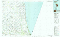
Croswell, Michigan, USGS topographic map dated 1984.
Includes geographic coordinates (latitude and longitude). This topographic map is suitable for hiking, camping, and exploring, or framing it as a wall map.
Printed on-demand using high resolution imagery, on heavy weight and acid free paper, or alternatively on a variety of synthetic materials.
Topos available on paper, Waterproof, Poly, or Tyvek. Usually shipping rolled, unless combined with other folded maps in one order.
- Product Number: USGS-5443558
- Free digital map download (high-resolution, GeoPDF): Croswell, Michigan (file size: 19 MB)
- Map Size: please refer to the dimensions of the GeoPDF map above
- Weight (paper map): ca. 55 grams
- Map Type: POD USGS Topographic Map
- Map Series: HTMC
- Map Verison: Historical
- Cell ID: 67365
- Scan ID: 278640
- Imprint Year: 1985
- Woodland Tint: Yes
- Aerial Photo Year: 1982
- Edit Year: 1984
- Datum: NAD27
- Map Projection: Universal Transverse Mercator
- Planimetric: Yes
- Map published by United States Geological Survey
- Map Language: English
- Scanner Resolution: 600 dpi
- Map Cell Name: Croswell
- Grid size: 30 X 60 Minute
- Date on map: 1984
- Map Scale: 1:100000
- Geographical region: Michigan, United States
Neighboring Maps:
All neighboring USGS topo maps are available for sale online at a variety of scales.
Spatial coverage:
Topo map Croswell, Michigan, covers the geographical area associated the following places:
- Pine Hill (historical) - Melvin - Lakeport - North Lakeport - Keewahdin - Croswell - Avoca - Merrillsville (historical) - Lexington - Blaine - Fargo - Buell Hill Estates Mobile Home Park - McGregor - Sandusky - Blue Water Beach - Ruby - Huron Shores Estates Mobile Home Park - Valley Center - Sunset Mobile Home Park - Lexington Heights - Speaker - Abbottsford - Applegate - Snover - Juhl - Brockway - Jeddo - Brown City - Country Hill Pines Mobile Home Park - Sandpiper Estates Cooperative Mobile Home Park - Port Sanilac - Roseburg - Watertown - Cash - Great Lakes Beach - Capac - Peck - North Hill Mobile Home Village - Gardendale - Huronia Heights - Forester - Atkins - Elmer - Lexington Mobile Home Park - Amadore - Birch Beach - Mapleview Estates Mobile Home Park - Carsonville - Yale
- Map Area ID: AREA43.543-83-82
- Northwest corner Lat/Long code: USGSNW43.5-83
- Northeast corner Lat/Long code: USGSNE43.5-82
- Southwest corner Lat/Long code: USGSSW43-83
- Southeast corner Lat/Long code: USGSSE43-82
- Northern map edge Latitude: 43.5
- Southern map edge Latitude: 43
- Western map edge Longitude: -83
- Eastern map edge Longitude: -82


