
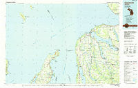
~ Charlevoix MI topo map, 1:100000 scale, 30 X 60 Minute, Historical, 1984, updated 1985
Charlevoix, Michigan, USGS topographic map dated 1984.
Includes geographic coordinates (latitude and longitude). This topographic map is suitable for hiking, camping, and exploring, or framing it as a wall map.
Printed on-demand using high resolution imagery, on heavy weight and acid free paper, or alternatively on a variety of synthetic materials.
Topos available on paper, Waterproof, Poly, or Tyvek. Usually shipping rolled, unless combined with other folded maps in one order.
- Product Number: USGS-5443548
- Free digital map download (high-resolution, GeoPDF): Charlevoix, Michigan (file size: 29 MB)
- Map Size: please refer to the dimensions of the GeoPDF map above
- Weight (paper map): ca. 55 grams
- Map Type: POD USGS Topographic Map
- Map Series: HTMC
- Map Verison: Historical
- Cell ID: 67272
- Scan ID: 278635
- Imprint Year: 1985
- Woodland Tint: Yes
- Aerial Photo Year: 1981
- Edit Year: 1984
- Datum: NAD27
- Map Projection: Universal Transverse Mercator
- Planimetric: Yes
- Map published by United States Geological Survey
- Map Language: English
- Scanner Resolution: 600 dpi
- Map Cell Name: Charlevoix
- Grid size: 30 X 60 Minute
- Date on map: 1984
- Map Scale: 1:100000
- Geographical region: Michigan, United States
Neighboring Maps:
All neighboring USGS topo maps are available for sale online at a variety of scales.
Spatial coverage:
Topo map Charlevoix, Michigan, covers the geographical area associated the following places:
- Finkton - Charlevoix Estates - Lake Terrace Mobile Court - Eastport - Advance - Lake Michigan Heights Mobile Home Park - Atwood - Bay Shore Estates - Barnard - Ironton - Omena - Horton Bay - Phelps - Boulder Park - Torch Lake - Peshawbestown - Central Lake - Snowflake (historical) - Chestonia - Boyne City - Wildwood - Burgess - Leland - Bay Shore - Norwood - Lakeview Mobile Home Village - North Manitou - Pleasant Valley - Creswell - Northport - Charlevoix - East Jordan Mobile Home Park - Forest Beach - Ellsworth - Ahgosatown - Zenith Heights - East Jordan
- Map Area ID: AREA45.545-86-85
- Northwest corner Lat/Long code: USGSNW45.5-86
- Northeast corner Lat/Long code: USGSNE45.5-85
- Southwest corner Lat/Long code: USGSSW45-86
- Southeast corner Lat/Long code: USGSSE45-85
- Northern map edge Latitude: 45.5
- Southern map edge Latitude: 45
- Western map edge Longitude: -86
- Eastern map edge Longitude: -85


