
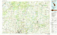
~ Cedar Springs MI topo map, 1:100000 scale, 30 X 60 Minute, Historical, 1986, updated 1989
Cedar Springs, Michigan, USGS topographic map dated 1986.
Includes geographic coordinates (latitude and longitude). This topographic map is suitable for hiking, camping, and exploring, or framing it as a wall map.
Printed on-demand using high resolution imagery, on heavy weight and acid free paper, or alternatively on a variety of synthetic materials.
Topos available on paper, Waterproof, Poly, or Tyvek. Usually shipping rolled, unless combined with other folded maps in one order.
- Product Number: USGS-5443546
- Free digital map download (high-resolution, GeoPDF): Cedar Springs, Michigan (file size: 26 MB)
- Map Size: please refer to the dimensions of the GeoPDF map above
- Weight (paper map): ca. 55 grams
- Map Type: POD USGS Topographic Map
- Map Series: HTMC
- Map Verison: Historical
- Cell ID: 67257
- Scan ID: 278634
- Imprint Year: 1989
- Woodland Tint: Yes
- Photo Inspection Year: 1986
- Aerial Photo Year: 1986
- Edit Year: 1985
- Datum: NAD27
- Map Projection: Universal Transverse Mercator
- Map published by United States Geological Survey
- Map Language: English
- Scanner Resolution: 600 dpi
- Map Cell Name: Cedar Springs
- Grid size: 30 X 60 Minute
- Date on map: 1986
- Map Scale: 1:100000
- Geographical region: Michigan, United States
Neighboring Maps:
All neighboring USGS topo maps are available for sale online at a variety of scales.
Spatial coverage:
Topo map Cedar Springs, Michigan, covers the geographical area associated the following places:
- Alton - Four Seasons Trailer Park - Kings Corner - Dennison - Six Lakes - Lisbon - Country View Estates Mobile Home Park - Solon Center - Woodcreek Village Estates Mobile Home Park - Oxbow - Parnell - Tamarack Estates Mobile Home Park - Evergreen Mobile Home Community - Woodland Estates Mobile Home Park - Sheffield - Sheridan - RIverview Mobile Home Park - Grattan - Lakeview - Chippewa Hills Trailer Court - Rockford - Ashland Center - Crickelwood Court Mobile Home Park - Timberline Estates Mobile Home Park - Croton Heights - Kent City Mobile Home Park - Harvard - Smyrna - Childsdale - Alpine - Bishop - Slocum - Herrington - Riverview - Chauteau Algoma Estates Mobile Home Park - Moseley - Fremont - Coopersville - Green Acres Mobile Home Park - Northern Estates Mobile Village South - Shiloh - Hill's Mobile Home Park - Edmore - Morley - Northern Estates Mobile Home Village North - Hiram - Glenwood Estates Mobile Home Park - Lakeview Homes Mobile Home Park - Reno - Amsden - Stanton Mobile Home Park - Meadowview Village Mobile Home Park - Orleans - Grant - Spring Valley Mobile Home Park - Eureka Place - Bridgeton - Grand Country Mobile Home Village - Kellys Corners - Hilltop Mobile Home Park - Evans - Wright - Kinney - Lamont - Marne - Moorland - Wilder Center - Leisure Village Mobile Home Park - Country Village Mobile Park - Conklin - Edmore Mobile Home Park - Bostwick Lake - Pierson - Cannonsburg - Brookhaven Estates Mobile Home Park - Fenwick - Westville - Trufant - Sand Lake - Entrican - Eastmanville - Cooks Corners - Canada Corners - Kent City - Sun - Sparta - Wierenga's Hess Lake Mobile Home Park - Edgerton - Bailey - Maple Hill - Chauncey - Ravenna - Comstock Park - Harrisburg - Greenville - Village Trails Mobile Home Community - Stanton - Turk Lake - Croton - Coral
- Map Area ID: AREA43.543-86-85
- Northwest corner Lat/Long code: USGSNW43.5-86
- Northeast corner Lat/Long code: USGSNE43.5-85
- Southwest corner Lat/Long code: USGSSW43-86
- Southeast corner Lat/Long code: USGSSE43-85
- Northern map edge Latitude: 43.5
- Southern map edge Latitude: 43
- Western map edge Longitude: -86
- Eastern map edge Longitude: -85


