
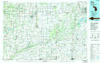
~ Alma MI topo map, 1:100000 scale, 30 X 60 Minute, Historical, 1985, updated 1991
Alma, Michigan, USGS topographic map dated 1985.
Includes geographic coordinates (latitude and longitude). This topographic map is suitable for hiking, camping, and exploring, or framing it as a wall map.
Printed on-demand using high resolution imagery, on heavy weight and acid free paper, or alternatively on a variety of synthetic materials.
Topos available on paper, Waterproof, Poly, or Tyvek. Usually shipping rolled, unless combined with other folded maps in one order.
- Product Number: USGS-5443526
- Free digital map download (high-resolution, GeoPDF): Alma, Michigan (file size: 24 MB)
- Map Size: please refer to the dimensions of the GeoPDF map above
- Weight (paper map): ca. 55 grams
- Map Type: POD USGS Topographic Map
- Map Series: HTMC
- Map Verison: Historical
- Cell ID: 67031
- Scan ID: 278622
- Imprint Year: 1991
- Woodland Tint: Yes
- Photo Inspection Year: 1988
- Aerial Photo Year: 1988
- Edit Year: 1985
- Datum: NAD27
- Map Projection: Universal Transverse Mercator
- Map published by United States Geological Survey
- Map Language: English
- Scanner Resolution: 600 dpi
- Map Cell Name: Alma
- Grid size: 30 X 60 Minute
- Date on map: 1985
- Map Scale: 1:100000
- Geographical region: Michigan, United States
Neighboring Maps:
All neighboring USGS topo maps are available for sale online at a variety of scales.
Spatial coverage:
Topo map Alma, Michigan, covers the geographical area associated the following places:
- Maple Rapids - Fordney - Shattuckville - Vestaburg - Shields - New Haven Center - Hubbardston - Forest Hill - Swan Creek - Pewamo - Riverdale - Strickland - Saint Charles - Sethton - Edgewood Village Mobile Home Park - Rathbone - Five Points North - Burton - Scotsdale Estates Mobile Home Park - Racy - Garfield - Timber Country Mobile Home Park - Meadows Mobile Home Park - Chapin - Shepardsville - Eureka - Woodcrest Estates Mobile Home Park - Iva - Marion Springs - Easton - Clausedale - Saint Johns - Orr - Coe - Ithaca - Elm Hall - Saint Johns Mobile Home Village - Oakley - Duplain - Eugene - Laporte - Lawndale - Henderson - North Wheeler - Breckenridge - Paines - Fenmore - Groveton - Edgewood - Luce - Bridgeville - Butternut - Dice - Brant - Frost - Lakefield - Summerton - Bannister - New Haven - Sumner - Sickles - Perrinton - Middleton - Hoovers Corners - Hemlock - Ovid - Ola - Chesaning - Meadow Lanes Estates Mobile Home Park - Vickeryville - Wolf Crossing - Stoddard Mobile Court - Pleasant Valley Estates Mobile Home Park - Brice - Redstone - Carson City - Ryan - Crystal - Olney Corners - Elwell - Evergreen Village Mobile Home Park - Newark - Smith Crossing - Elsie - Roosevelt - Nesen's Countryside Mobile Home Park - Alicia - Langport - Northwood Estates Mobile Home Park - Breckenridge Mobile Home Park - Carland - Cedar Lake - Lawndale Estates Mobile Home Park - Ashley - Galloway - Kris Kay Mobile Home Park - Parshallburg - Nelson - Pompeii - Alma
- Map Area ID: AREA43.543-85-84
- Northwest corner Lat/Long code: USGSNW43.5-85
- Northeast corner Lat/Long code: USGSNE43.5-84
- Southwest corner Lat/Long code: USGSSW43-85
- Southeast corner Lat/Long code: USGSSE43-84
- Northern map edge Latitude: 43.5
- Southern map edge Latitude: 43
- Western map edge Longitude: -85
- Eastern map edge Longitude: -84


