
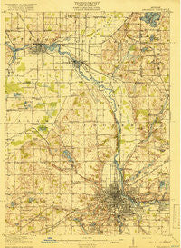
~ Kalamazoo MI topo map, 1:62500 scale, 15 X 15 Minute, Historical, 1918
Kalamazoo, Michigan, USGS topographic map dated 1918.
Includes geographic coordinates (latitude and longitude). This topographic map is suitable for hiking, camping, and exploring, or framing it as a wall map.
Printed on-demand using high resolution imagery, on heavy weight and acid free paper, or alternatively on a variety of synthetic materials.
Topos available on paper, Waterproof, Poly, or Tyvek. Usually shipping rolled, unless combined with other folded maps in one order.
- Product Number: USGS-5442846
- Free digital map download (high-resolution, GeoPDF): Kalamazoo, Michigan (file size: 8 MB)
- Map Size: please refer to the dimensions of the GeoPDF map above
- Weight (paper map): ca. 55 grams
- Map Type: POD USGS Topographic Map
- Map Series: HTMC
- Map Verison: Historical
- Cell ID: 55959
- Scan ID: 278242
- Woodland Tint: Yes
- Survey Year: 1916
- Datum: Unstated
- Map Projection: Unstated
- Map published by United States Geological Survey
- Map Language: English
- Scanner Resolution: 600 dpi
- Map Cell Name: Kalamazoo
- Grid size: 15 X 15 Minute
- Date on map: 1918
- Map Scale: 1:62500
- Geographical region: Michigan, United States
Neighboring Maps:
All neighboring USGS topo maps are available for sale online at a variety of scales.
Spatial coverage:
Topo map Kalamazoo, Michigan, covers the geographical area associated the following places:
- Parchment - Doster - Huntington Run Mobile Home Park - Westwood - Weatherstone Village Mobile Home Park - Franklin Valley Estates Mobile Home Park - Plainwell - Country Acres Village Mobile Home Park - Highland Hills Mobile Home Park - Watson's Mobile Home Park - Millwood Mobile Home Park - Kalamazoo - Oakbrook Mobile Home Park - Cooper - Alamo - East Cooper - Comstock - Doughertys Corners - Oshtemo - Milwood - Hillcrest Acres Mobile Home Park - Fountain Springs Mobile Home Park - Gun River Mobile Estates - Evergreen Park Mobile Home Park - Colonial Manor Mobile Home Park - Meadow View Village Mobile Home Park - Northwood - Gun River West Mobile Home Park - Lakewood - Eastwood - Royal Estates Mobile Home Park - Sherwood Forest Mobile Home Park - Otsego - Oakwood - Americana Estates Mobile Home Park - Selkirk Mobile Home Park
- Map Area ID: AREA42.542.25-85.75-85.5
- Northwest corner Lat/Long code: USGSNW42.5-85.75
- Northeast corner Lat/Long code: USGSNE42.5-85.5
- Southwest corner Lat/Long code: USGSSW42.25-85.75
- Southeast corner Lat/Long code: USGSSE42.25-85.5
- Northern map edge Latitude: 42.5
- Southern map edge Latitude: 42.25
- Western map edge Longitude: -85.75
- Eastern map edge Longitude: -85.5


