
~ Town Corners MI topo map, 1:25000 scale, 7.5 X 7.5 Minute, Historical, 1983, updated 1983
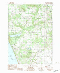
Town Corners, Michigan, USGS topographic map dated 1983.
Includes geographic coordinates (latitude and longitude). This topographic map is suitable for hiking, camping, and exploring, or framing it as a wall map.
Printed on-demand using high resolution imagery, on heavy weight and acid free paper, or alternatively on a variety of synthetic materials.
Topos available on paper, Waterproof, Poly, or Tyvek. Usually shipping rolled, unless combined with other folded maps in one order.
- Product Number: USGS-5442026
- Free digital map download (high-resolution, GeoPDF): Town Corners, Michigan (file size: 13 MB)
- Map Size: please refer to the dimensions of the GeoPDF map above
- Weight (paper map): ca. 55 grams
- Map Type: POD USGS Topographic Map
- Map Series: HTMC
- Map Verison: Historical
- Cell ID: 45493
- Scan ID: 277734
- Imprint Year: 1983
- Woodland Tint: Yes
- Aerial Photo Year: 1977
- Edit Year: 1983
- Field Check Year: 1979
- Datum: NAD27
- Map Projection: Lambert Conformal Conic
- Provisional map: Yes
- Map published by United States Geological Survey
- Map Language: English
- Scanner Resolution: 600 dpi
- Map Cell Name: Town Corners
- Grid size: 7.5 X 7.5 Minute
- Date on map: 1983
- Map Scale: 1:25000
- Geographical region: Michigan, United States
Neighboring Maps:
All neighboring USGS topo maps are available for sale online at a variety of scales.
Spatial coverage:
Topo map Town Corners, Michigan, covers the geographical area associated the following places:
- Woodland School - Stony Lake Cemetery - Town Corners - Saint John's Catholic Cemetery - Trinity Church - Stony Lake Oil Field - Trinity Lutheran Cemetery - Dorrance Creek - Saint Stephen's Lutheran Cemetery - Saddleback Lake - Cranston Cemetery - Girdle Road School - Saint Johns Church - Piper Creek - Stoney Haven Campground - Whisky Creek - Claybanks Post Office (historical) - Park Lake - Pine Grove School - Marshville Roadside Park - Marshville Post Office (historical) - Jakes Lake - Peace Church - Saint Stephens Church - Cranston School - Marshville Pond - Burke Creek - Benona School - Long Lake - Peace Cemetery - Bender Creek - Pine Grove Cemetery - Stony Lake - Township of Benona - Shelby Road Church - Claybanks Township Park - Bradyville School - Benona Township Hall Historical Marker - Gardner Cemetery - Claybanks Township Memorial Park - Township of Claybanks - Mason Creek - Grand View Golf Course
- Map Area ID: AREA43.62543.5-86.5-86.375
- Northwest corner Lat/Long code: USGSNW43.625-86.5
- Northeast corner Lat/Long code: USGSNE43.625-86.375
- Southwest corner Lat/Long code: USGSSW43.5-86.5
- Southeast corner Lat/Long code: USGSSE43.5-86.375
- Northern map edge Latitude: 43.625
- Southern map edge Latitude: 43.5
- Western map edge Longitude: -86.5
- Eastern map edge Longitude: -86.375


