
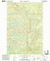
~ Summit Lake MI topo map, 1:24000 scale, 7.5 X 7.5 Minute, Historical, 1999, updated 2004
Summit Lake, Michigan, USGS topographic map dated 1999.
Includes geographic coordinates (latitude and longitude). This topographic map is suitable for hiking, camping, and exploring, or framing it as a wall map.
Printed on-demand using high resolution imagery, on heavy weight and acid free paper, or alternatively on a variety of synthetic materials.
Topos available on paper, Waterproof, Poly, or Tyvek. Usually shipping rolled, unless combined with other folded maps in one order.
- Product Number: USGS-5441314
- Free digital map download (high-resolution, GeoPDF): Summit Lake, Michigan (file size: 15 MB)
- Map Size: please refer to the dimensions of the GeoPDF map above
- Weight (paper map): ca. 55 grams
- Map Type: POD USGS Topographic Map
- Map Series: HTMC
- Map Verison: Historical
- Cell ID: 43753
- Scan ID: 277355
- Imprint Year: 2004
- Woodland Tint: Yes
- Aerial Photo Year: 1999
- Edit Year: 1999
- Datum: NAD27
- Map Projection: Lambert Conformal Conic
- Map published by United States Forest Service
- Map Language: English
- Scanner Resolution: 600 dpi
- Map Cell Name: Summit Lake
- Grid size: 7.5 X 7.5 Minute
- Date on map: 1999
- Map Scale: 1:24000
- Geographical region: Michigan, United States
Neighboring Maps:
All neighboring USGS topo maps are available for sale online at a variety of scales.
Spatial coverage:
Topo map Summit Lake, Michigan, covers the geographical area associated the following places:
- Little East Branch Huron River - Lake Elinor - Island Lake - Trout Lake - Four Island Lake - Lake Vedder - Clear Lake - Baraga Creek - Camp Eleven Creek - Lake Arfelin - Sawyer Lake County Park - Evergreen Lake - Lake Phillips - Corner Lake - Big Bear Lake - Lake Alice - High Lake - White Deer Lake Trail - Camp Eleven Lake - Little Bear Lake - Lower Baraga Lake - Summit Lake - Township of Michigamme - Upper Baraga Lake Trail - Lower Baraga Lake Trail - Cedar Lake - Hasseib Lake - Little West Branch Huron River - Lake Gordon - Charles Lake - Ephriam Creek - McCormick Wilderness - Hebert Lake - Lake Sally Lou - Boniface Camp - Upper Baraga Lake - Lake Dortay - White Deer Lake
- Map Area ID: AREA46.7546.625-88.125-88
- Northwest corner Lat/Long code: USGSNW46.75-88.125
- Northeast corner Lat/Long code: USGSNE46.75-88
- Southwest corner Lat/Long code: USGSSW46.625-88.125
- Southeast corner Lat/Long code: USGSSE46.625-88
- Northern map edge Latitude: 46.75
- Southern map edge Latitude: 46.625
- Western map edge Longitude: -88.125
- Eastern map edge Longitude: -88


