
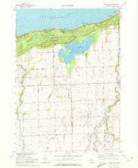
~ Rush Lake MI topo map, 1:24000 scale, 7.5 X 7.5 Minute, Historical, 1970, updated 1972
Rush Lake, Michigan, USGS topographic map dated 1970.
Includes geographic coordinates (latitude and longitude). This topographic map is suitable for hiking, camping, and exploring, or framing it as a wall map.
Printed on-demand using high resolution imagery, on heavy weight and acid free paper, or alternatively on a variety of synthetic materials.
Topos available on paper, Waterproof, Poly, or Tyvek. Usually shipping rolled, unless combined with other folded maps in one order.
- Product Number: USGS-5440926
- Free digital map download (high-resolution, GeoPDF): Rush Lake, Michigan (file size: 12 MB)
- Map Size: please refer to the dimensions of the GeoPDF map above
- Weight (paper map): ca. 55 grams
- Map Type: POD USGS Topographic Map
- Map Series: HTMC
- Map Verison: Historical
- Cell ID: 71464
- Scan ID: 277149
- Imprint Year: 1972
- Woodland Tint: Yes
- Aerial Photo Year: 1968
- Field Check Year: 1970
- Datum: NAD27
- Map Projection: Polyconic
- Map published by United States Geological Survey
- Map Language: English
- Scanner Resolution: 600 dpi
- Map Cell Name: Rush Lake
- Grid size: 7.5 X 7.5 Minute
- Date on map: 1970
- Map Scale: 1:24000
- Geographical region: Michigan, United States
Neighboring Maps:
All neighboring USGS topo maps are available for sale online at a variety of scales.
Spatial coverage:
Topo map Rush Lake, Michigan, covers the geographical area associated the following places:
- Harrison Drain - Tait Farms - Roundtree Dairy - Chandler Township Cemetery - Phillip County Park - Thompson Drain - Albert E Sleeper State Park Campground - Depener Farms - Gotts Corners - Oak Beach County Park - Fisher Drain - Conkey Drain - Little Oak Point - Caseville Golf Course - Rush Lake Drain - Fisher Drain - Rush Lake - Bad Axe Creek - Albert E Sleeper State Park - Gotts Post Office (historical) - Musselman Drain - Township of Chandler - McKay Cemetery - Chandler Church - Van Drain - Chandler Church - Thompson County Park - McCormick Drain
- Map Area ID: AREA4443.875-83.25-83.125
- Northwest corner Lat/Long code: USGSNW44-83.25
- Northeast corner Lat/Long code: USGSNE44-83.125
- Southwest corner Lat/Long code: USGSSW43.875-83.25
- Southeast corner Lat/Long code: USGSSE43.875-83.125
- Northern map edge Latitude: 44
- Southern map edge Latitude: 43.875
- Western map edge Longitude: -83.25
- Eastern map edge Longitude: -83.125


