
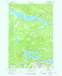
~ Negaunee SW MI topo map, 1:24000 scale, 7.5 X 7.5 Minute, Historical, 1954, updated 1977
Negaunee SW, Michigan, USGS topographic map dated 1954.
Includes geographic coordinates (latitude and longitude). This topographic map is suitable for hiking, camping, and exploring, or framing it as a wall map.
Printed on-demand using high resolution imagery, on heavy weight and acid free paper, or alternatively on a variety of synthetic materials.
Topos available on paper, Waterproof, Poly, or Tyvek. Usually shipping rolled, unless combined with other folded maps in one order.
- Product Number: USGS-5440226
- Free digital map download (high-resolution, GeoPDF): Negaunee SW, Michigan (file size: 11 MB)
- Map Size: please refer to the dimensions of the GeoPDF map above
- Weight (paper map): ca. 55 grams
- Map Type: POD USGS Topographic Map
- Map Series: HTMC
- Map Verison: Historical
- Cell ID: 31501
- Scan ID: 276783
- Imprint Year: 1977
- Woodland Tint: Yes
- Photo Revision Year: 1975
- Aerial Photo Year: 1975
- Field Check Year: 1954
- Datum: NAD27
- Map Projection: Polyconic
- Map published by United States Geological Survey
- Map Language: English
- Scanner Resolution: 600 dpi
- Map Cell Name: Negaunee SW
- Grid size: 7.5 X 7.5 Minute
- Date on map: 1954
- Map Scale: 1:24000
- Geographical region: Michigan, United States
Neighboring Maps:
All neighboring USGS topo maps are available for sale online at a variety of scales.
Spatial coverage:
Topo map Negaunee SW, Michigan, covers the geographical area associated the following places:
- Silver Creek - Clark Creek - Gold Mine Creek - Mather Mine A - Mother Baseball Diamond - Teal Lake Medical Center - Teal Lake - Willow Creek - Deer Creek - Lloyd Mine - WJPD-AM (Ishpeming) - Big Mud Lake - Deer Lake - Bethany Lutheran Church - Little Dead River - Temple Beth Sholom - Cooper Lake - Zhulkie Creek - Ishpeming: Historic Ski Center Historical Marker - Little Lake - Morris Mine - Birchview Elementary School - Carp Creek - Lake Bacon - Country Village RV Park - Baby Lake - Boise Creek - Saint Joseph Church - Dead River Storage Basin - Lily Pond - Cooper Creek - Wesley United Methodist Church - Ishpeming Cemetery - Cambria-Jackson Mine - Silver Mine Lakes - Al Quaal Recreation Area - UPHS Bell Hospital - Barnhardt Creek
- Map Area ID: AREA46.62546.5-87.75-87.625
- Northwest corner Lat/Long code: USGSNW46.625-87.75
- Northeast corner Lat/Long code: USGSNE46.625-87.625
- Southwest corner Lat/Long code: USGSSW46.5-87.75
- Southeast corner Lat/Long code: USGSSE46.5-87.625
- Northern map edge Latitude: 46.625
- Southern map edge Latitude: 46.5
- Western map edge Longitude: -87.75
- Eastern map edge Longitude: -87.625


