
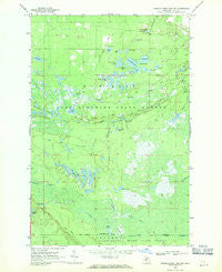
~ Muskallonge Lake SW MI topo map, 1:24000 scale, 7.5 X 7.5 Minute, Historical, 1968, updated 1970
Muskallonge Lake SW, Michigan, USGS topographic map dated 1968.
Includes geographic coordinates (latitude and longitude). This topographic map is suitable for hiking, camping, and exploring, or framing it as a wall map.
Printed on-demand using high resolution imagery, on heavy weight and acid free paper, or alternatively on a variety of synthetic materials.
Topos available on paper, Waterproof, Poly, or Tyvek. Usually shipping rolled, unless combined with other folded maps in one order.
- Product Number: USGS-5440178
- Free digital map download (high-resolution, GeoPDF): Muskallonge Lake SW, Michigan (file size: 11 MB)
- Map Size: please refer to the dimensions of the GeoPDF map above
- Weight (paper map): ca. 55 grams
- Map Type: POD USGS Topographic Map
- Map Series: HTMC
- Map Verison: Historical
- Cell ID: 31193
- Scan ID: 276755
- Imprint Year: 1970
- Woodland Tint: Yes
- Aerial Photo Year: 1964
- Field Check Year: 1968
- Datum: NAD27
- Map Projection: Polyconic
- Map published by United States Geological Survey
- Map Language: English
- Scanner Resolution: 600 dpi
- Map Cell Name: Muskallonge Lake SW
- Grid size: 7.5 X 7.5 Minute
- Date on map: 1968
- Map Scale: 1:24000
- Geographical region: Michigan, United States
Neighboring Maps:
All neighboring USGS topo maps are available for sale online at a variety of scales.
Spatial coverage:
Topo map Muskallonge Lake SW, Michigan, covers the geographical area associated the following places:
- Holland Lake State Forest Campground - Tank Lake - Bullhead Lake - North Branch Two Hearted River - Pratt Lake - Wheeler Lake - Bob Lake - Deer Lake - Camp One Creek - Kilp Lake - South Branch Two Hearted River - Beaverhouse Lake - Brush Lake - North Branch Lakes - Holland Lake - Dairy Creek - Pratt Lake Campground - Jack Creek - Sid Lake - Johns Creek - Long Lake - Camp Eight Lake - Ladue Lake - Two Hearted Lakes - West Branch Two Hearted River - Pretty Lake - Lookout Tower Campground - Jack Lake - Otter Lake - Evergreen Lake - Beavertown Lakes - Beaver Lake - Pretty Lake State Forest Campground - Little Whorl Lake - Whorl Lake
- Map Area ID: AREA46.62546.5-85.75-85.625
- Northwest corner Lat/Long code: USGSNW46.625-85.75
- Northeast corner Lat/Long code: USGSNE46.625-85.625
- Southwest corner Lat/Long code: USGSSW46.5-85.75
- Southeast corner Lat/Long code: USGSSE46.5-85.625
- Northern map edge Latitude: 46.625
- Southern map edge Latitude: 46.5
- Western map edge Longitude: -85.75
- Eastern map edge Longitude: -85.625


