
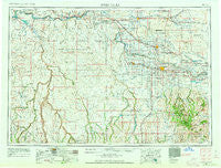
~ Twin Falls ID topo map, 1:250000 scale, 1 X 2 Degree, Historical, 1955, updated 1963
Twin Falls, Idaho, USGS topographic map dated 1955.
Includes geographic coordinates (latitude and longitude). This topographic map is suitable for hiking, camping, and exploring, or framing it as a wall map.
Printed on-demand using high resolution imagery, on heavy weight and acid free paper, or alternatively on a variety of synthetic materials.
Topos available on paper, Waterproof, Poly, or Tyvek. Usually shipping rolled, unless combined with other folded maps in one order.
- Product Number: USGS-5437734
- Free digital map download (high-resolution, GeoPDF): Twin Falls, Idaho (file size: 17 MB)
- Map Size: please refer to the dimensions of the GeoPDF map above
- Weight (paper map): ca. 55 grams
- Map Type: POD USGS Topographic Map
- Map Series: HTMC
- Map Verison: Historical
- Cell ID: 69066
- Scan ID: 239684
- Imprint Year: 1963
- Woodland Tint: Yes
- Edit Year: 1962
- Field Check Year: 1955
- Datum: Unstated
- Map Projection: Transverse Mercator
- Map published by United States Geological Survey
- Map Language: English
- Scanner Resolution: 600 dpi
- Map Cell Name: Twin Falls
- Grid size: 1 X 2 Degree
- Date on map: 1955
- Map Scale: 1:250000
- Geographical region: Idaho, United States
Neighboring Maps:
All neighboring USGS topo maps are available for sale online at a variety of scales.
Spatial coverage:
Topo map Twin Falls, Idaho, covers the geographical area associated the following places:
- Fairview - McHenry - Wickahoney - Dans Place - Knull - Gooding - Haytown (historical) - Fuller - Duncan Place - Hand Place - Sugar Loaf - Garrard Ranch - Greenwood - Hoelzle Place - Tunupa - Hansen - Tindall (historical) - Hollister - Hillsdale (historical) - Tuttle - Iversons - Austin (historical) - Besslen - Bliss - Wendell - James Place - Hagerman - Kimberly - Anderson Place - Abbey (historical) - Dickens Place - Grasmere - Dew Drop Place - Filer - Artesian City - Bengoechea Place - Rock House Place - May Place - Chalk Cut - Castleford - Falls City - Curry - Threemile Crossing - Bickel (historical) - Hunt - Godwin - Harrell Place - Appleton - Barrymore - McMillan - Murtaugh - Buhl - Rogerson - Berger - Bergstrom Place - Murphy Hot Springs - Bills - China Hat - Shoshone - Eden - Dietrich - Peavey - Bruneau - Perrine - Player Place - Three Creek - Milner - Hammett - Hydra - Clover - Amsterdam - Twin Falls - Rock Creek - Hot Springs - Frost Place - Striker - Roseworth - Cedar - Jerome - Vosburg Place - Tipperary Corner - Hazelton - Owinza - Deep Creek - Glenns Ferry - Indian Jim Place
- Map Area ID: AREA4342-116-114
- Northwest corner Lat/Long code: USGSNW43-116
- Northeast corner Lat/Long code: USGSNE43-114
- Southwest corner Lat/Long code: USGSSW42-116
- Southeast corner Lat/Long code: USGSSE42-114
- Northern map edge Latitude: 43
- Southern map edge Latitude: 42
- Western map edge Longitude: -116
- Eastern map edge Longitude: -114


